Understanding how material released into the ocean spreads is very important in the case of oil spills, sediment transport and the release of invasive species.
How material is distributed from an initial source depends on the nature of the material itself and the complex flow of water around the coast and ocean of New Zealand.
The properties that determine this spread (or dispersal) are:
- the mean water flow,
- the variability of this mean flow with time , at each point in the ocean.
- how the material interacts with this flow.
Given the size of the NZ EEZ, actually measuring all this information is practically impossible. However, there are mathematical models of these flows that are quite reliable. One of the oceanic modelling tools in use at NIWA is the Regional Ocean Modelling System (ROMS), an open source code resulting from an international collaboration of many institutions and researchers.

Using ROMS we can replace the impossible task of constantly measuring the flow at every point in the ocean, with comparing how well the model performs in comparison to the available data, and using the model results where there are no data.
Connectivity is the relationship between material released at one location and its chances of reaching another location. Dispersal measures the rate at which material released at a point is spread by the flow. In order to quantify connectivity and dispersal for flows, the model needs to provide:
- its best estimates of the mean flow and variance, and
- track the movement of material within that flow.
The combination of both these elements is needed to predict how material disperses, and start to answer questions like, ''if I put a message in a bottle off Tauranga, will it ever get to Bluff?"
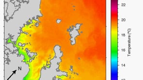
These are two more model output examples from this kind of work performed by NIWA.
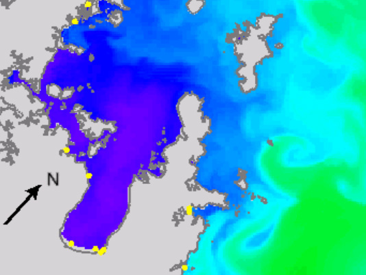
A model of sea surface temperature in the Hauraki Gulf using ROMS.
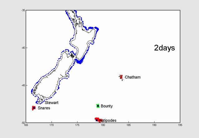
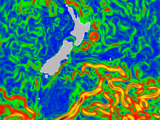
Simulated particle movement in model near-surface NZ EEZ ocean flows for particles released around the NZ coastline.