Advanced understanding of the physical impacts of sea-level rise
Part 1: Freshwater-saltwater interface led by - Rogier Westerhoff (GNS)
Part 2: Wetland and intertidal evolution led by - Andrew Swales (NIWA)
Research goals
- Build a national database and interactive web-based maps of coastal wetlands, land-use and asset exposure in coastal lowlands with relative SLR.
- Produce a high-resolution, time-evolving, online mapping tool of Aotearoa-New Zealand’s freshwater-saltwater interface.
- Develop models to predict how estuarine saltmarsh habitats will evolve globally significant science advances will be required to understand ecosystem response and habitat evolution, and to identify adaption tipping-points and opportunities for wetland preservation or re-establishment.
Research projects:
- Losing ground to sea-level rise: Mangroves on the atoll of Ouvéa are struggling with the changing climate
- Parsimonious estuary model to simulate the impact of sea-level rise
- A comprehensive national groundwater data layer for New Zealand
- Mapping elevation capital
- Student updates
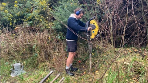
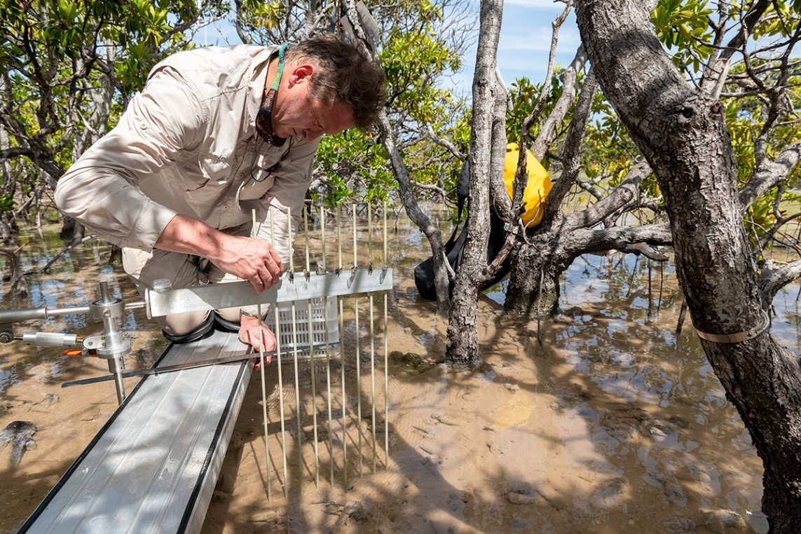
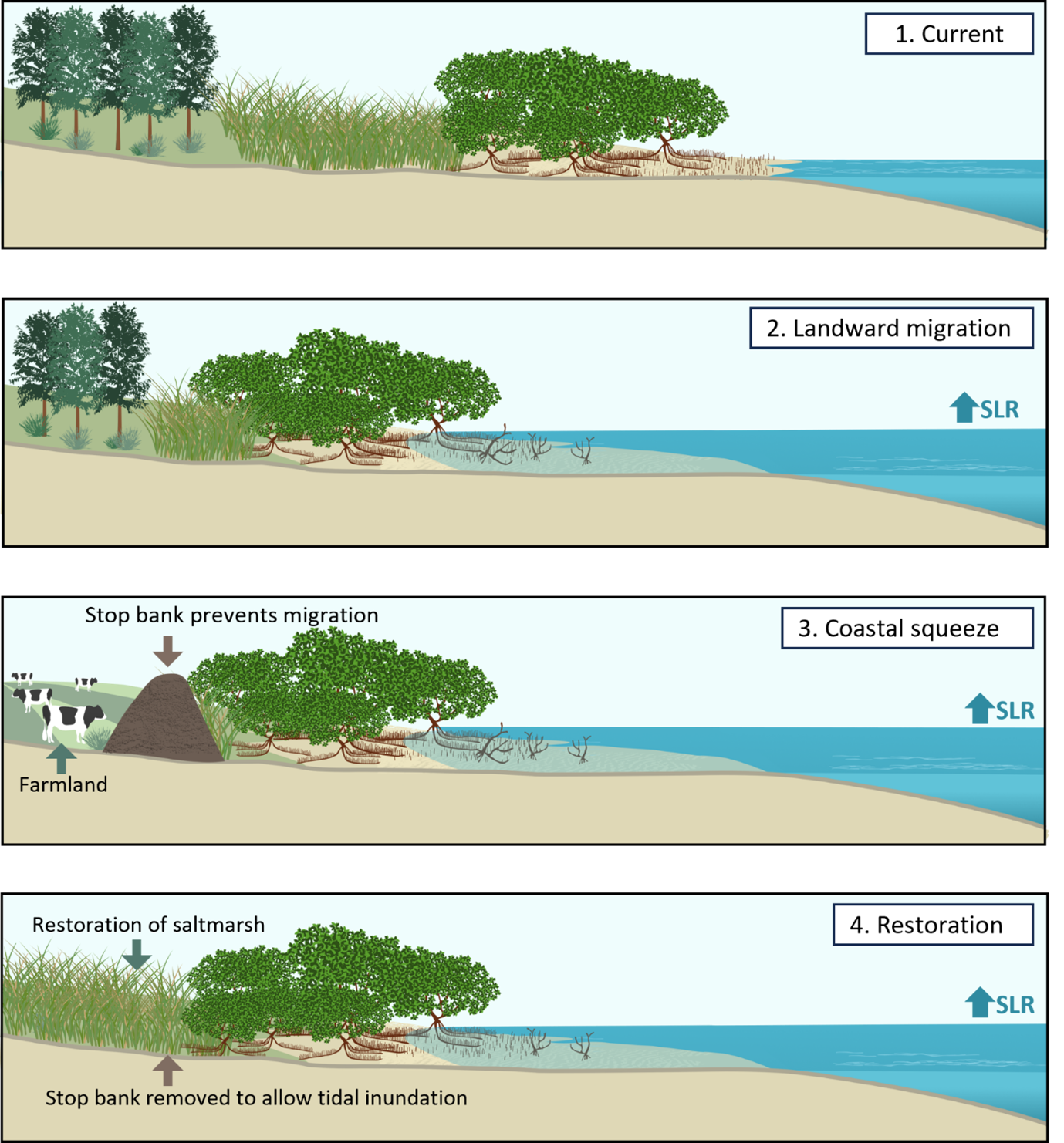
Losing ground to sea-level rise: Mangroves on the atoll of Ouvéa are struggling with the changing climate.
Observations of a Pacific atoll mangrove forest over the last several years by a NIWA-led research team suggest that mangrove systems on oceanic atolls may lose the race to keep pace with sea-level rise.
These findings are consistent with previous studies which show global sea level rise, driven by climate warming, threatens the future of mangrove forests that fringe the shorelines of temperate and tropical regions, including New Zealand’s upper North Island.
Mangroves cannot be permanently submerged, so must maintain their position in the intertidal zone by accreting mineral and organic sediment. Consequently, sediment supply is critical to the resilience of mangrove forests to sea-level rise.
Sea-level rise poses a different challenge for New Zealand’s coastal mangrove habitats. In some estuaries, rivers will deliver sufficient sediment for mangroves to gain sufficient elevation to be resilient to future sea-level rise.
But in sediment-poor systems, mangroves will need room to retreat inland as the sea level rises.
The Future Coasts Aotearoa Endeavour research programme is addressing how coastal wetlands in New Zealand will respond to sea-level rise and identify opportunities for wetland restoration in lowlands as they salinize and inundate.
Click link below to find out more about this research:
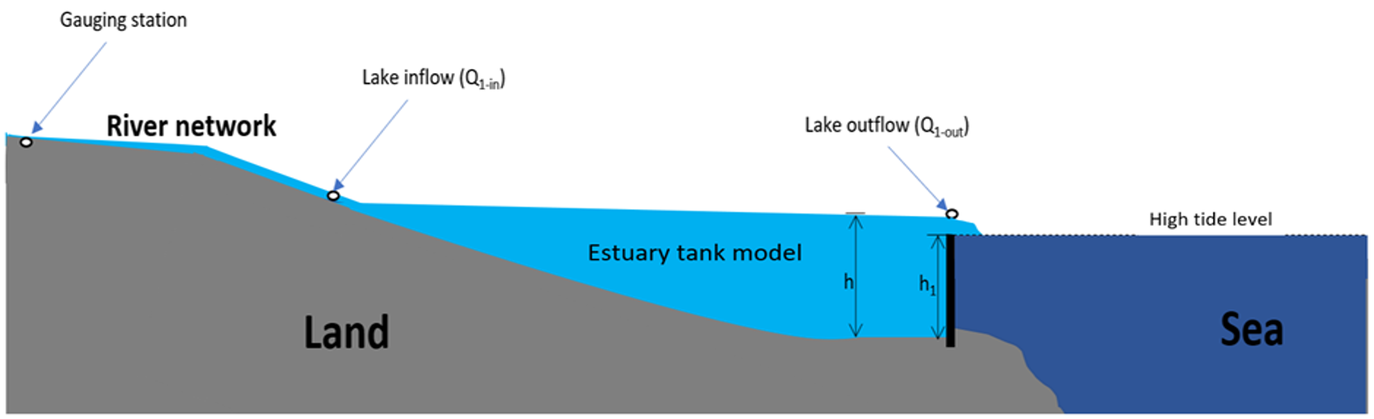
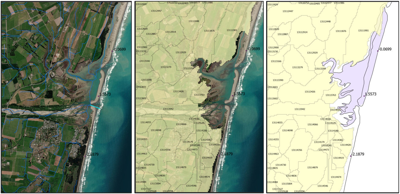
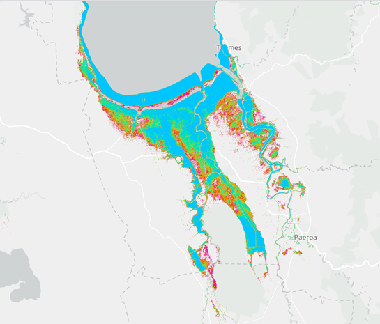
Parsimonious estuary model to simulate the impact of sea-level rise
The New Zealand Water Model (NZWaM), which currently models river flows across New Zealand, is being used to simulate the impact of tidal inundation on estuary water levels during high flow events. This is achieved by using a parsimonious ‘tank model’ to represent an estuary at high tide (Figure 1). The model is currently being validated for the Ashley River in Canterbury (Figure 2) and will then be used to assess the impact of higher tidal inundation associated with future sea-level rise scenarios. The model will be trialled at two other locations in New Zealand with a view to extending the model at a national scale.
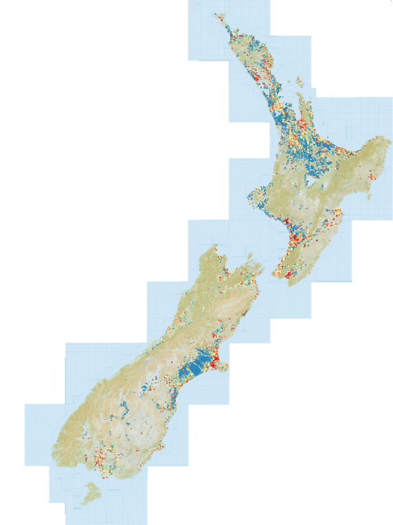
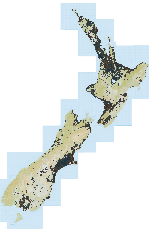
A comprehensive national groundwater data layer for New Zealand
Groundwater level data is a key input to our understanding of both current and future shallow groundwater hazards in our coastal lowlands and to a broader range of water resource investigation, management and research activities. Access to national groundwater level data in New Zealand is challenging, however, because the data is held in the various Regional Council and Unitary Authority databases and the New Zealand Geotechnical Database under a wide array of data architectures. The quality of the data and metadata varies significantly; in some instances, the data is subject to rigorous quality assurance processes and includes accurate measurement point elevations. In other instances, the data comprises of single readings of unknown quality with no information on the measurement point elevation or even the depth of the well.
The Kōmanawa Solutions Ltd team required a comprehensive national groundwater level data set to train a machine learning model for the prediction of shallow groundwater hazard areas in the coastal zone. After obtaining complete database downloads from the 16 Regional Council and Unitary Authorities and from the New Zealand Geotechnical Database covering 113,418 sites across the country and 5.5 million discrete readings in total, the team dedicated 300 hours to restructuring the data into a standard format. This huge task included querying Lidar data sources for elevation data where missing; reprojecting the data to a consistent datum and coordinate reference system; calculating statistics for sites with multiple readings over time; assigning a quality rating score to the data; and generating a suite of metadata for each site. The team is in the process of publishing this national groundwater data layer in conjunction with the Python code developed for the data processing to facilitate efficient future updates of the data layer as more groundwater level data is collected nationally. We anticipate that the layer will prove to be a valuable resource for water resource researchers, groundwater practitioners and engineers throughout Aotearoa New Zealand.
Mapping Elevation Capital
In our research we aim to map the migration space or elevation capital for coastal habitats under sea-level-rise. As sea level rises, coastal land is inundated and can become suitable for colonisation by coastal organisms such as saltmarshes, mangroves, and seagrasses. To determine if there is space for habitats to migrate inland, we will predict what coastal areas will become inundated under a range of sea level rise scenarios. In some cases, urban developments such as sea walls, roads, or settlements with inhibit inland migration – this is known as coastal squeeze. In other areas, natural barriers such as hills will block migration. In connected areas, with no barriers (human-made or elevation), there will be greater opportunity for inland migration under sea level rise – this is called elevation capital. We will map these processes at case study sites around Aotearoa, NZ.
Student Updates
Irene Setiawan
Riparian saltwater intrusion: implications, dynamics, and vulnerability under sea level rise.
Dr Irene Setiawan graduated with a PhD in late 2023 for her thesis entitled Riparian saltwater intrusion: implications, dynamics, and vulnerability under sea level rise. She was supervised by Dr Leanne Morgan and Dr Crile Doscher and her final year was financially supported by the Future Coasts Aotearoa Programme. Irene is now working at Mahaanui Kurataiao Ltd. In Christchurch. Irene developed new physically based saltwater intrusion vulnerability tiers as part of her work. Her recent paper applied analytic solutions along surface water bodies under sea level rise in GIS and shows how saltwater intrusion vulnerability increases upstream of rivers with sea level rise.
Publications:
Setiawan, I., Morgan, L. K., & Doscher, C. (2024). Mapping the vulnerability of groundwater to saltwater intrusion from estuarine rivers under sea level rise.
Source: Journal of Hydrology, 628, 130461. https://doi.org/10.1016/j.jhydrol.2023.130461

Amandine Bosserelle
PhD candidate Amandine Bosserelle recently published her study of the characteristics of shallow groundwater, including spatial and temporal trends in depths to groundwater and their relationship to natural and anthropogenic stressors. Understanding the spatial and temporal variability of shallow groundwater in urban coastal settings is key for evaluation of coastal groundwater hazards and monitoring infrastructure planning to provide early warnings of potential adaptation thresholds.
Publications:
Bosserelle, A. L., Morgan, L. K., Dempsey, D. E., & Setiawan, I. (2023). Shallow groundwater characterisation and hydrograph classification in the coastal city of Ōtautahi/Christchurch, New Zealand. Hydrogeology Journal, 1-24 https://doi.org/10.1007/s10040-023-02745-z

Matthew Jones
Data worth analysis to improve modelling of shallow groundwater levels under sea-level rise
Data worth analysis to improve modelling of shallow groundwater levels under sea-level rise is the focus of Matthew Jones’ Masters in Water Resource Management degree. He is being supervised by Dr Leanne Morgan (UC) and Dr Wes Kitlasten (GNS). His scholarship is supported by GNS as part of the Future Coasts Aotearoa programme. Matthew is working on a master’s project developing a groundwater model to make predictions of how shallow groundwater levels in the coastal region between the Ashley and Waimakariri Rivers in North Canterbury will respond to sea-level rise. This project has the eventual intention of performing data worth analysis to identify locations for additional groundwater monitoring sites to best improve model predictions and lower predictive uncertainties. Sparse subsurface data in the area contributes to model predictive uncertainty and limits the ability of the model to provide useful information. History matching to existing observational water-level data helps reduce model uncertainty but is also limited by available data. Being able to select locations for additional monitoring which can provide data to best reduce model predictive error will be useful. To do this, model predictive uncertainty is quantified, and data worth analysis used to identify locations for additional monitoring which could have the greatest effect in reducing this predictive uncertainty. Being able to make accurate predictions about the localised effects of sea-level rise on groundwater is important for effective planning. It is hoped that the results of this investigation will be beneficial in decision making for designing the local groundwater monitoring network and planning for the effects of sea-level rise. The project is currently at the stage of numerical model development and will next move to parameter estimation and uncertainty analysis. Matthew is studying towards a Master of Water Resource Management at University of Canterbury supervised by Dr Leanne Morgan (UC) and Dr Wes Kitlasten (GNS). He was due to submit at the end of May this year.

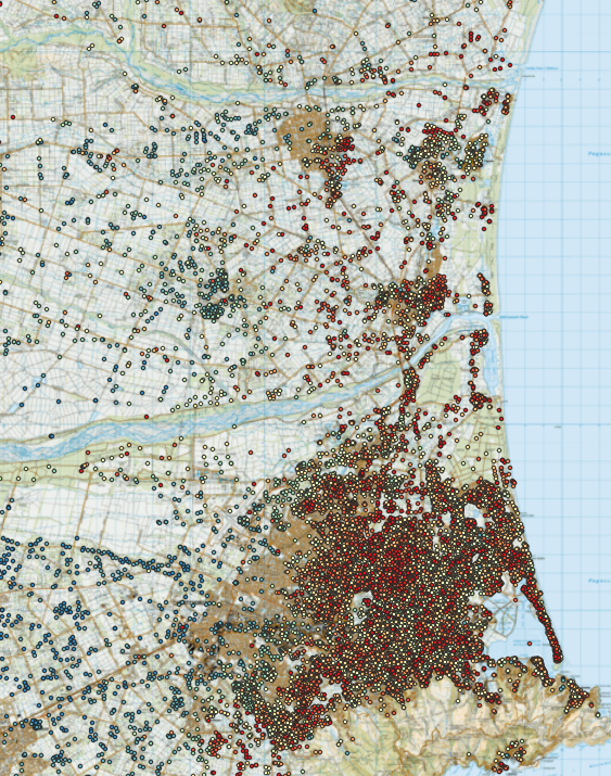
Des McCloy
Modelling to support robust coastal groundwater hazard adaptation planning
MSc candidate Des McCloy has evaluated the sensitivity of coastal groundwater hazard exposure assessments to water table depth modelling methods as part of his MSc thesis, sponsored by the Future Coast Aotearoa programme. The work used a range of data inputs and interpolation methods plus two national model water table surfaces to quantify the area of assets that could be exposed to shallow groundwater impacts under the status quo and under a 1 m sea level rise scenario. The results for residential buildings (fig xx below) show a very wide range of status quo and potential future hazard exposure levels across the six water table surfaces used for the assessment. The detailed local model showed significantly lower exposure than the national-scale models and generalised local models and aligned best with the results of a resident's survey on current groundwater hazard exposure in the case study area. This information will be a key input to guidance on data gathering and modelling methods to support robust coastal groundwater hazard adaptation planning. Des is finalising his thesis for submission in February 2024.