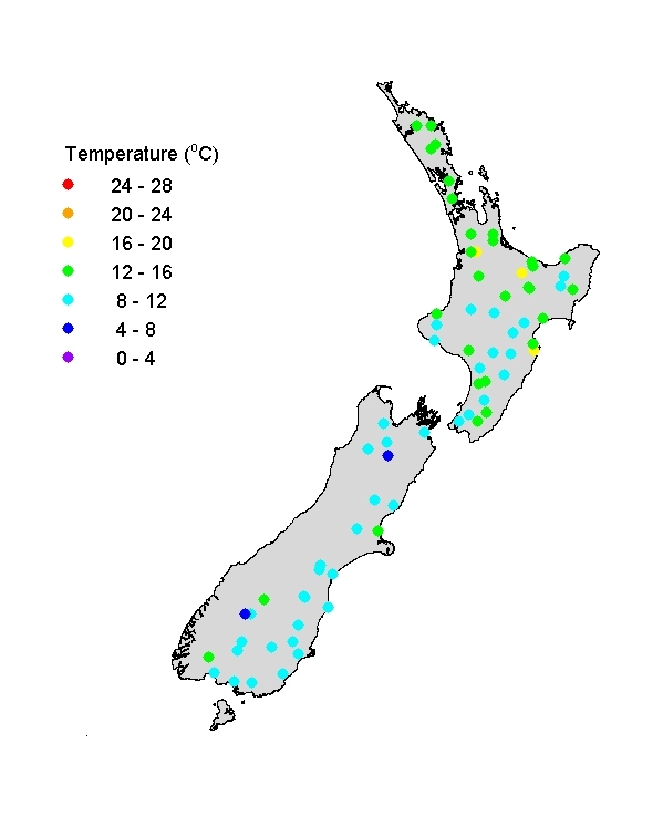
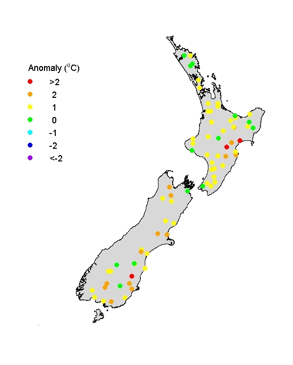
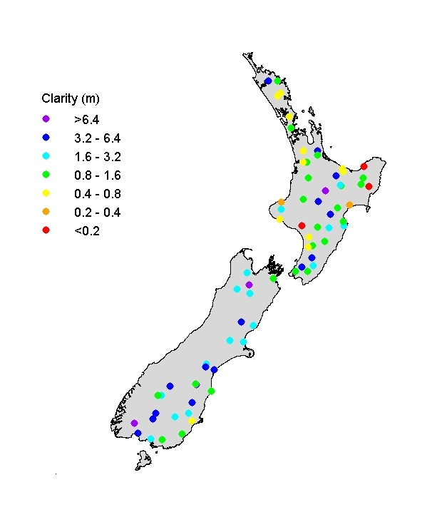
River Temperatures
Autumn river water temperatures ranged from about 8°C in the southern South Island (lower in a few high altitude catchments) to >16°C in central North Island – generally showing the typical altitudinal trend super-imposed on a weak (S-N) latitudinal trend. River water temperatures were higher (by 1-2°C) than normal for autumn over large parts of the country, and were appreciably higher in Hawkes Bay and large areas of the South Island. Visual clarity of rivers reflects geology, soil, and land use patterns. Mudstone areas (e.g., East Cape) and clay soils (e.g., Northland) tend to produce low visual clarity particularly in rivers with pasture catchments. Visual clarity also depends on state of flow, and rivers tend to be relatively turbid (i.e., have low clarity) in high flows.
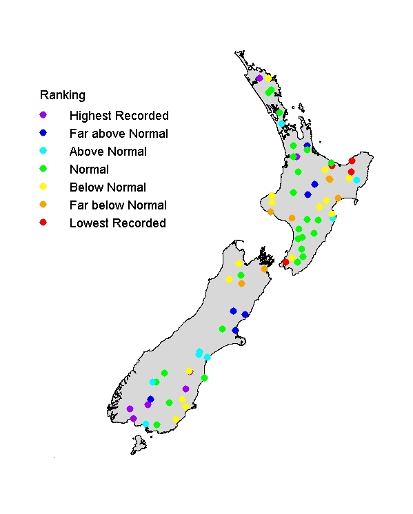
Visual clarity of rivers
Visual clarity ranges widely, being typically high in catchments draining erosion-resistant rocks and low in areas of soft sedimentary rock and in pastoral catchments. Visual clarity varied appreciably from 'usual' conditions, probably because of considerable variation in state-of-flow (visual clarity is strongly inversely related to flow condition in rivers). The Motu River (near East Cape, NI) and Hutt River (southern South Island) were both unusually turbid, and rivers in southern SI were unusually clear.