Niwa meteorologists continue to cast a watchful eye over two strengthening tropical cyclones in the South Pacific.
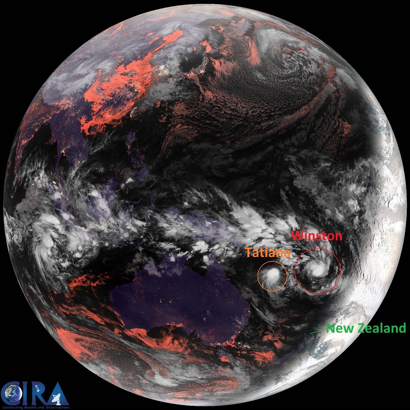
Tropical Cyclones Winston and Tatiana formed in the South Pacific on Thursday night. Winston, the stronger of the two cyclones, is packing sustained winds of 100km/h (gusts 130km/h) and is approximately 450km east-northeast of Port Vila, Vanuatu. Tatiana has sustained winds of 80km/h (gusts 100km/h) and is approximately 445km northwest of Nouméa, New Caledonia. On the infrared satellite image, Winston is circled in red and Tatiana in Orange; for reference, New Zealand is also marked in green.
Winston is forecast to pass 40-80km east of Vanuatu’s southernmost island of Aneityum tonight while continuing to strengthen. The potent storm will continue on a southward progression into the open waters of the South Pacific on Saturday. Later Saturday and on Sunday, the storm is forecast to be at its strongest point, with sustained winds of over 200km/h. At this time, Winston is expected to make a turn to the east and then north on Sunday, taking it away from New Zealand.
Meanwhile, Tatiana is expected to track southward across the open waters of the Coral Sea on Saturday while strengthening. While this storm is not expected to be as strong as Winston, it may still produce sustained winds in excess of 100km/h at its strongest point. The cyclone’s southward progression is forecast to slow on Sunday as it slowly weakens over the Coral Sea into Monday.
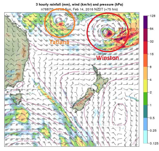
The graphic to the right illustrates the storms’ forecast position at 4pm on Sunday.
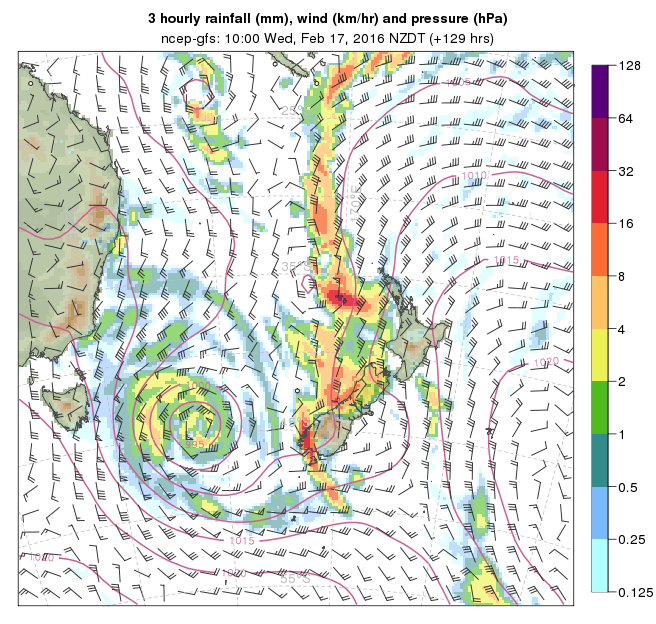
As for impacts to New Zealand, North Island beachgoers should be aware of an enhanced east to northeasterly swell that will intensify as the weekend goes on and continue into next week. On Tuesday and Wednesday, another storm system passing south of Australia may intercept some tropical moisture from both Tatiana and Winston. If this happens, some heavy rainfall and strong, gusty winds could affect New Zealand. It is too early, however, to forecast detail for this event. Despite this, a direct impact from either cyclone seems rather unlikely at this time. The image below illustrates the risk for some heavy rain and wind across the country mid-week next week.
Related news