Summer is for scientific fieldwork. Three NIWA scientists are heading into the wild blue yonder, some with fancy technology and others with a coffee cup and a bag of party balloons.
Jet boating up the Waimakariri River in search of salmon
Phil Jellyman is jet boating up the Waimakariri River in Canterbury – not because it’s a fun thing to do but in search of salmon. The NIWA freshwater fish ecologist is planning to implant acoustic tags on the fish to find out whether irrigation schemes are affecting their migration to spawning grounds up river.
Along the river he will install about 25 receivers that will gather information transmitted from the tags on the salmon’s whereabouts.
The Waimakariri has a reputation as one of New Zealand’s top salmon fishing rivers, and at 151 km long is one of the largest in North Canterbury. Irrigation schemes allow farmers to extract water from the river for most of spring and summer but recent schemes are targeting floodwaters for harvesting, however little is known about how that could affect the movement of salmon.
“We want to know what sized flood is prompting their movements up the river and how their upstream migration to spawning grounds is affected when water is taken from the river.”
Salmon typically migrate when the water is dirty after the peak of a flood, probably because the dirtier floodwater gives them more cover, is slightly cooler and taps into some innate instinct they have, so the aim is to find out how much the flow harvesting by irrigation schemes could potentially delaying the upstream movements of these fish.
“The salmon are coming in from mid-December onwards to get to their spawning grounds from April onwards. The upstream movement of salmon is happening at the same time that irrigation intake is at its peak.”
The aim is to tag about 10 fish a month from January on – but Dr Jellyman admits it’s a high risk project that relies on them being able to net the fish in the first place. The Waimakariri is a braided river that also changes frequently which makes locating the fish a more difficult task.
“We’ll be trying it in mid-January. Salmon are a good species to target as they are large and will not be affected by the size of the tag we implant…and we know roughly when they’ll arrive and where they want to get to in the catchment. We need to surgically implant the tags which are about 3 cm long by 2 cm wide, so that adds an extra degree of difficulty.” NIWA will be partnering with North Canterbury Fish & Game and aims to ensure salmon anglers understand the project is important for the long-term sustainability of the fishery.
Heading to the hills
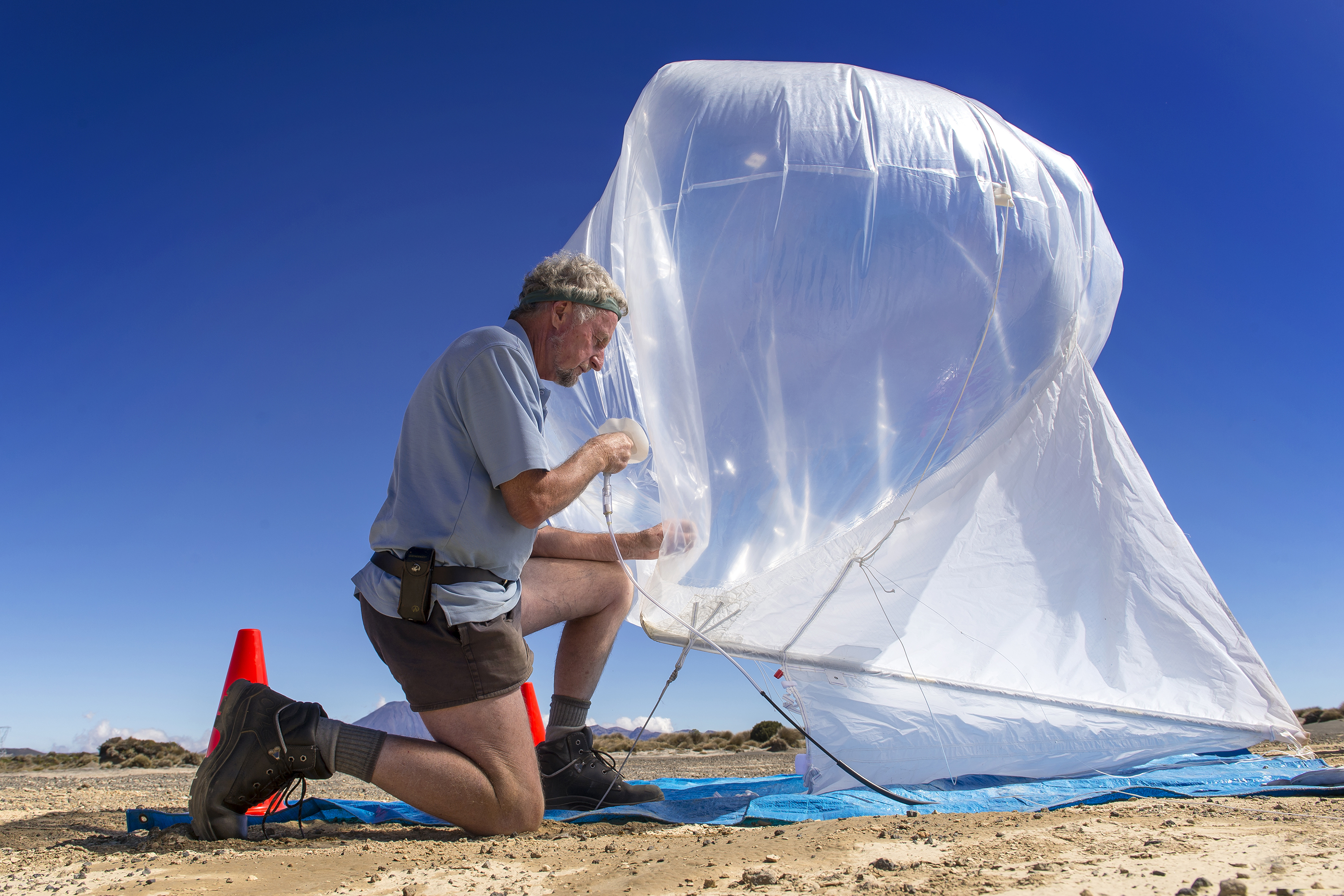
When Tony Bromley heads to the hills in January he’s taking along a bag of party balloons and some cardboard coffee cups to help him with some complex measurements involving power lines along the National Grid.
The NIWA atmospheric technician is aiming “to define the sag”.
“Power lines expand with heat and the more power that goes down the line the hotter they get. When that happens the lines sag in the middle of the span between power pylons. It’s essential to know how low the sag could go to ensure the lines aren’t going to touch anything.”
Measuring the potential depth of a sag involves complex calculations involving temperature, wind speed and direction, pressure, humidity and solar radiation measurements many metres off the ground. For instance, the wind has a cooling effect but the amount of cooling depends if it is travelling across or along the lines.
All these measurements are used as part of the equation to work out the minimum distance between the lines and other objects, such as trees. Too close means the risk of outages and other issues. A helicopter will operate at the same time taking precise distance measurements via laser.
Mr Bromley and his team will cover 1600km of lines over four weeks from Southland to the Bay of Plenty and Auckland. They will set up temporary meteorological stations at ground level along the length of the lines and then fill party balloons with helium.
The balloons will be attached to the biodegradable coffee cups which contain transmitting sensors sending weather information back to the ground. Once a pre-set height has been reached, some clever programming triggers an electric current that burns through the string, releasing the balloon. The coffee cup falls to the ground, is retrieved and used again.
“The transmitters will only need to ascend to a height of around 100m at most, so we can see where they land. They also transmit a signal giving their actual location on the ground and a small handheld GPS unit can be used to direct us to that location - very useful if the transmitter is hidden in long grass. It is a very efficient use of our technology especially being able to re-use the instruments many times.”
7000kms of seabed research
Fieldwork will see marine ecologist Dr David Bowden travel more than 7000km over January. He is leading a voyage aboard NIWA research vessel Tangaroa to study seabed habitats of the Chatham Rise, east of New Zealand.
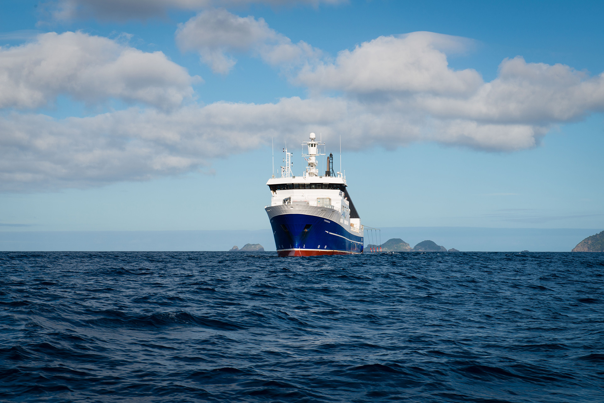
The Chatham Rise, which stretches for about 1000km from near the South Island to the Chatham Islands, is one of New Zealand’s most productive fisheries areas. The major hoki and orange roughy fisheries are here and it is also abundant in hake, ling and scampi.
Dr Bowden’s aim on this voyage is to find out more about what lives on the seabed.
“If we, as a society, want to use the seabed we need to know what kinds of fauna and habitats are there and how these are likely to be affected by disturbances such as trawling. But it’s not easy to do that. As with most areas of the deep-sea, the seabed fauna of Chatham Rise have been sampled at relatively few locations. We use statistical modelling methods to predict what might be in between these locations but a lot of uncertainty remains.”
Photographic sampling – using still and video cameras – will improve knowledge of what lives on the seabed, while a multi-corer will provide data about seafloor sediments.
“Distributions of animals on the seabed are influenced by their physical habitat, so we want to know what the seabed sediments are like in this highly productive part of the ocean.”
The month-long voyage, funded by the Ministry for Primary Industries, leaves Wellington on January 5 and is the first of its kind since 2007.
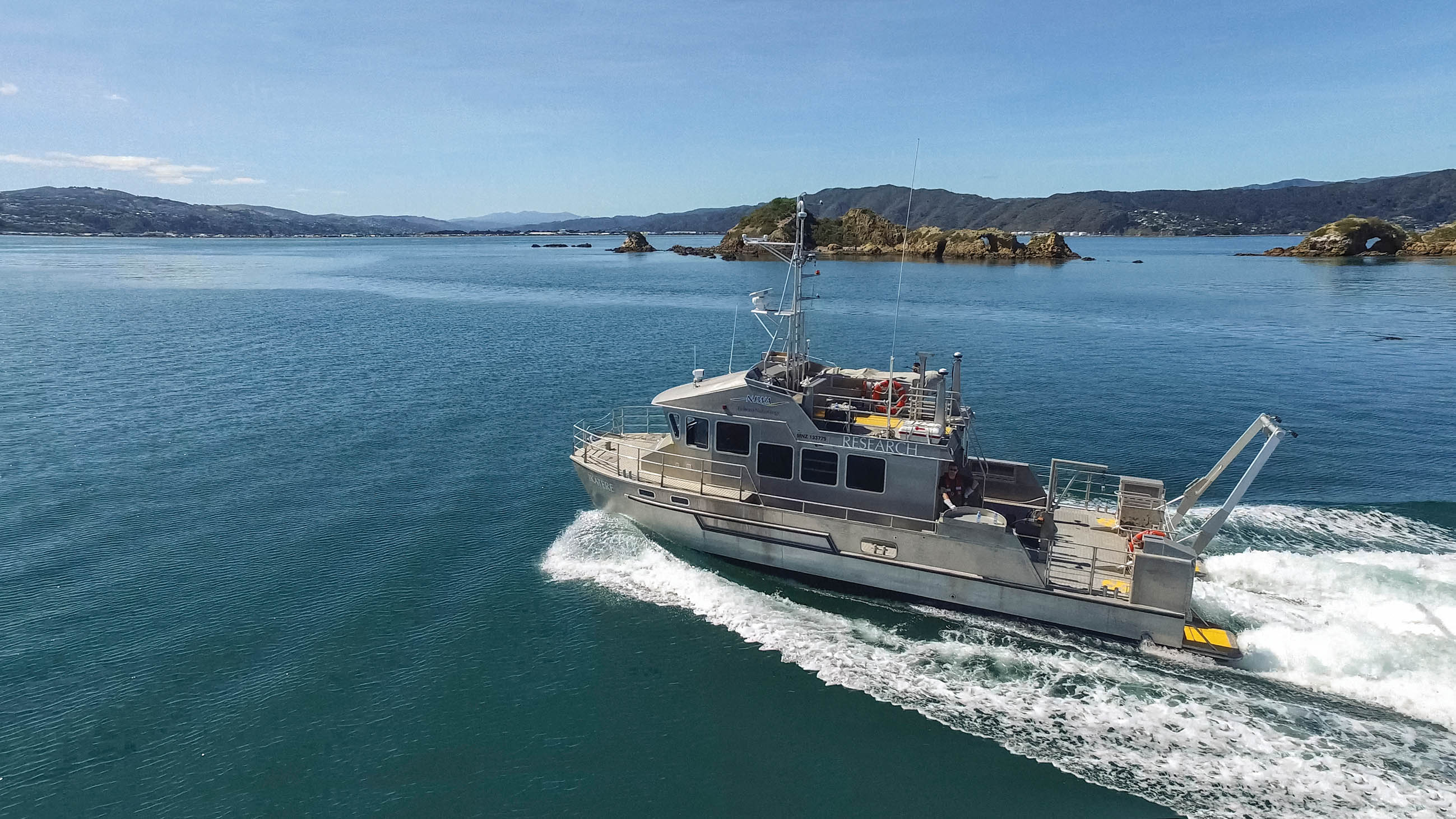
Remapping the Kaikoura Canyon rim
Meanwhile, another NIWA vessel is heading to the Kaikoura Canyon at about the same time to examine how it might have changed since November’s MW7.8 earthquake. The canyon comes within 500m of the coast south of Kaikoura. Marine geologist Dr Joshu Mountjoy will use scanning technology aboard research vessel Ikatere to remap the canyon rim.