Mt Tongariro erupted at 11.52pm on 6 August.
These latest infra-red satellite images of ash clouds over New Zealand were created using the NOAA 18 and 19 satellites.
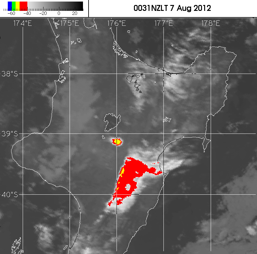
The first map, 0031 NZLT 7 August, was taken 39 minutes after the eruption.
NIWA Principal Scientist Michael Uddstrom, "What we are seeing [in this map] is infra-red imagery measured by the satellite during the event." It shows the eruption cloud from the event. The cloud is 25 kilometres long and 15 kilometres wide.
The temperature at the top of the cloud (associated with the eruption) is minus 54 degrees centigrade and it's about 12 kilometres high at its highest point in the atmosphere.
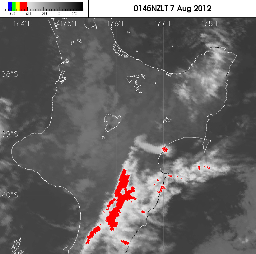
The second map, 0145 NZLT 7 August, was taken 113 minutes after the eruption.
The second map show the cloud as it extends from 176.4 degrees to 177.0 degrees east on the east coast of the North Island. At 1:45am the highest cloud was just over the coast, south of Wairoa, in the Central Hawkes Bay.
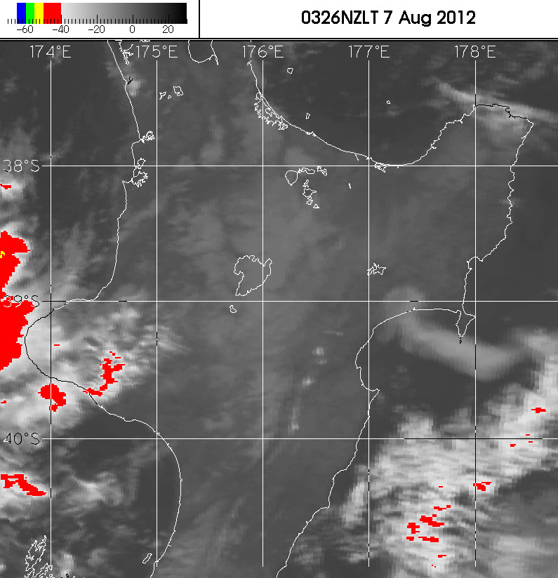
The third map, 0326 NZLT 7 August was taken 214 minutes after the eruption.
The third map shows the cloud south of Mahia, extending out from Hawke Bay.
The cloud has travelled 250 kilometres in four hours at an average speed of 18 metres per second.
"It's rapidly blowing out to the east of New Zealand," says NIWA's Dr Richard Turner.
See the maps at: http://www.niwa.co.nz/gallery/mt-tongariro-eruption.