Fine sediment runoff from deforested and disturbed catchments is recognised by management agencies as being the principal threat to New Zealand's estuarine ecosystems.
Models are important tools for managing the threat. They predict among other things, the fate of sediments delivered to estuaries in freshwater runoff during rainstorms, patterns of annual- and decadal-scale sedimentation, interactions of sediments with other contaminants such as heavy metals and the spread of marginal vegetated habitats (mangroves).
Estuary hydrodynamic and sediment-transport models linked to catchment sediment-runoff models, so-called "source-to-sea models", are used to predict effects on estuarine ecosystems of landuse intensification and change and catchment urbanisation. Results are used in risk assessments and to develop policy and rules in regional plans, to design catchment mitigation measures, and to assist decision-making under the Resource Management Act.
A key unsolved problem for all of New Zealand's aquatic ecosystems is the management of the cumulative effects of diffuse-source contaminants. In response, and building on the National Policy Statement for Freshwater Management promulgated in 2011, the Land and Water Forum has recently recommended to Government that standards and associated limits be widely applied in freshwater management, and the Forum is now turning its attention to estuary management. We anticipate that any shift to limits-based management of estuaries is going to be heavily dependent on there being good predictive models available. For example, we have recently developed a method for calculating catchment sediment load limits to achieve estuarine sedimentation targets that is based on inverting – or "running backwards" – a source-to-sea model.
Against this background, we have launched a large multidisciplinary research programme in the Kaipara Harbour and its surrounding catchment to:
- advance our understanding of the effects of multiple contaminant stressors (fine sediments, nutrients and heavy metals) on estuarine ecosystems
- understand and develop predictive models of the effects of fine sediment on estuary water clarity
- extend our ability to build source-to-sea models
- improve models for predicting the dispersal of contaminants by river plumes that discharge into estuaries
- develop methods and tools to support limits-based management of estuaries.
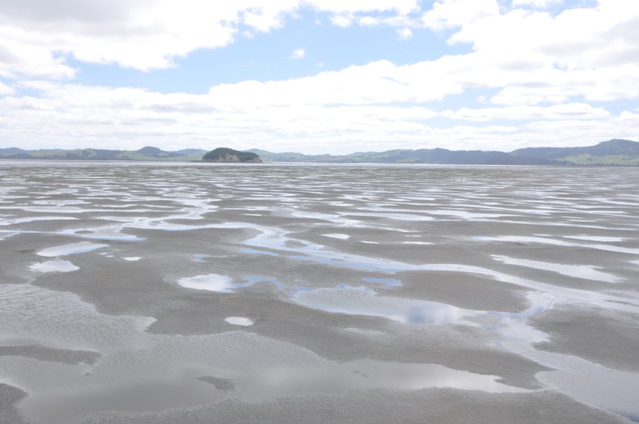
Kaipara Harbour, which drains to the west into the Tasman Sea, north of Auckland, is the largest estuary in New Zealand. The southern part of the harbour features extensive intertidal sand flats, mudflats, mangrove stands, and small sheltered embayments into which tidal creeks discharge. The northern part of the harbour features deeply indented river/tidal tributaries. Recent state-of-the-environment reports have documented a decline in the harbour ecosystem, with loss of habitat, decline in fisheries and shellfisheries, spread of mangroves and the accumulation of mud in previously sandy areas. Both Auckland Council and Northland Regional Council are under increasing public and political pressure to improve management of the Kaipara catchment and harbour. Both councils have demonstrated their support of and commitment to our work programme.
Estuarine and riverine monitoring stations have been set up in two focus areas. These are in the Hoteo catchment and immediate harbour receiving waters (southern sector of harbour), and a portion of the Wairoa River catchment and immediate harbour receiving waters (northern sector of harbour). A whole-harbour hydrodynamics / sediment-transport model is being implemented to support the research.
NIWA's work in the Kaipara is supported by MBIE through the Management of Cumulative Effects of Stressors on Aquatic Ecosystems programme. We are collaborating with AgResearch's Clean Water / Productive Land programme to link our work on contaminant fate and effects with their work on catchment critical source areas, which will help to effectively target mitigation, and with Landcare Research's Values, Monitoring and Outcomes programme to link to their work on implementing regional policy for catchment management and iwi freshwater values. We are also working with Ngati Whatua to rollout out the iwi estuarine monitoring toolkit Nga Waihotanga Iho, and to develop cultural report cards for the harbour. Uptake of research results is being facilitated by the Integrated Kaipara Harbour Management Group.
In the first year of the programme we have used natural isotopic tracers to build a picture of sources of sediment to the harbour, which distinguishes between different landuses in the catchment. This is now helping to inform recommendations on targeting of mitigation in the catchment to most effectively reduce sedimentation in critical harbour habitats. A key goal of the programme is to develop a comprehensive set of catchment sediment load limits that will deliver a range of ecological and amenity objectives in the harbour.
Contact: Malcolm Green NIWA Hamilton, Richard MacDowell AgResearch Invermay, Suzie Greenhalgh Landcare Research Auckland.