-

New Zealand to have world-leading hazard risk modelling tool
Media release01 August 2019EQC, GNS Science and NIWA have joined forces to further develop world-leading natural hazards risk modelling for New Zealand. -

NIWA mapping Whakatipu lake floor
Media release08 May 2019NIWA researchers are out on Lake Whakatipu for the next week mapping the lake floor for the first time. -

Tracing tsunamis through history
Weaving whakapapa and science together to trace tsunami through history. -

Scientists confirm former site of Pink and White Terraces
Media release29 November 2018The diary and hand-drawn maps of a nineteenth century geologist has enabled NIWA scientists to confirm the former site of the iconic Pink and White Terraces at Lake Rotomahana. -

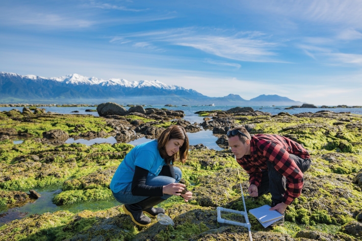
Kaikōura earthquake provides world-first insight into submarine canyons
Feature story17 October 2018Research conducted after the 2016, 7.8 magnitude Kaikōura earthquake has provided scientists with an extremely rare opportunity to understand the processes that shape submarine canyons. -
Drones watch quake aftermath
Feature story19 April 2018NIWA scientists like Leigh Tait were saddened by the human impact of the 2016 Kaikoura earthquake, but he also says that it provided a “massive natural history experiment”. -

2018 - OBS Recovery
VoyageThe RV Tangaroa is assisting in New Zealand’s largest ever deployment of seafloor earthquake recording instruments in a bid to learn more about the earthquake behaviour of the tectonic plates beneath the east coast of the North Island. -
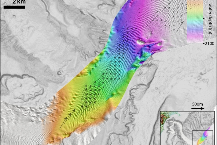
Kaikōura earthquake generated huge submarine sediment shift
Media release15 March 2018The 2016 Kaikōura Earthquake has shown that more than 100 million dumptrucks of mud and sand flow through the Kaikōura Canyon every 140 years, scientists say. -
2017 - Hikurangi subduction zone
The Tangaroa assisted in New Zealand’s largest ever deployment of seafloor earthquake recording instruments in a bid to learn more about the earthquake behaviour of the tectonic plates beneath the east coast of the North Island. -

NIWA co-leads international expedition to study New Zealand’s largest earthquake fault
Media release21 November 2017An ambitious scientific expedition involving 30 scientists from around the world leaves Perth next week bound for the East Coast of the North Island. -
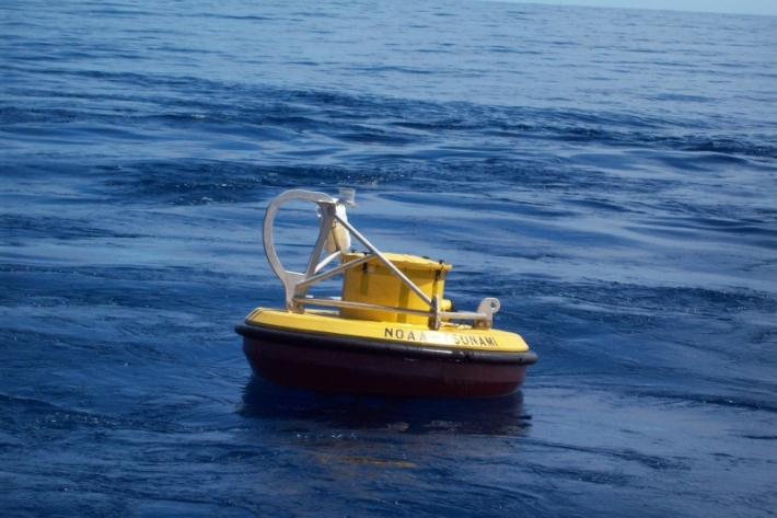
2017 - NOAA tsunami warning station
A tsunami reporting station situated in the Pacific Ocean that is currently off line is to be upgraded in a joint operation involving New Zealand and United States government agencies.
