-

Kaikōura Canyon
Our team of researchers have recently returned from a voyage onboard RV Tangaroa to retrieve moorings deployed to collect sediment samples from the Kaikōura Canyon. -

Underwater robot getting close-up look at Kaikōura Canyon
Media release08 October 2020A six-metre long orange underwater robot is flying through the Kaikōura Canyon for the next month collecting information on how the canyon has changed since the 2016 earthquake. -

New tsunami monitoring system for Pacific
Feature story22 September 2020A network of state-of-the-art tsunami buoys is being deployed from New Zealand up into the Pacific to keep communities safer. -

Tsunami evacuation zones home to 1 in 10 New Zealanders
Media release19 August 2020NIWA scientists have completed the first national assessment of people and buildings at risk in New Zealand’s tsunami evacuation zones. -

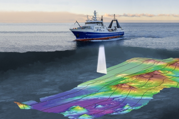
A flair for finding gas bubble flares
NIWA marine geologist Arne Pallentin is looking for telltale gas bubble 'flares"—using a multibeam echosounder—that indicate new volcanic activity in the Calypso Vent Field. -

Using sound to see what's happening geologically
Marine geologist - Dr Joshu Mountjoy - is mapping the seafloor landscape around Whakaari/White Island to understand how much sediment was dislodged in the eruption and where it has gone. -

What's in a bubble?
Marine Geophysicist Sally Watson, maps the seafloor and takes samples from the water column so we can understand geological processes shaping the volcanic underwater realm around Whakaari/White Island. -
2020 - Bay of Plenty acoustics
During the TAN2007 voyage NIWA scientists headed to the waters around Whakaari/White Island in the Bay of Plenty to survey changes to the seafloor since the volcanic eruption in December 2019. -

NIWA mapping seafloor around Whakaari/White Island
Media release16 July 2020NIWA scientists are heading to the waters around Whakaari/White Island in the Bay of Plenty next week to survey changes to the seafloor. -

Scientists get first look at rocks causing slow moving quakes
Media release26 March 2020An ambitious international scientific project to study New Zealand’s largest earthquake fault is now enabling scientists to learn more about slow slip earthquakes happening in subduction zones around the world. -

Scientist pieces together details of underwater landslides
Media release28 November 2019New information about landslides that occur on the seafloor off New Zealand’s east coast will help scientists better understand why and where they happen, and the types of threats they pose. -

Methane seep research bubbling along
Media release10 September 2019A chance discovery off the Gisborne coast five years ago is prompting a NIWA scientist to find out more about the link between a field of methane seeps bubbling out of the sea floor and submarine landslides.