Advanced understanding of the physical impacts of sea-level rise
Part 1: Freshwater-saltwater interface led by - Rogier Westerhoff (GNS)
Part 2: Wetland and intertidal evolution led by - Andrew Swales (NIWA)
Research goals
- Build a national database and interactive web-based maps of coastal wetlands, land-use and asset exposure in coastal lowlands with relative SLR.
- Produce a high-resolution, time-evolving, online mapping tool of Aotearoa-New Zealand’s freshwater-saltwater interface.
- Develop models to predict how estuarine saltmarsh habitats will evolve globally significant science advances will be required to understand ecosystem response and habitat evolution, and to identify adaption tipping-points and opportunities for wetland preservation or re-establishment.
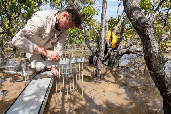
Losing ground to sea-level rise: Mangroves on the atoll of Ouvéa are struggling with the changing climate.
Observations of a Pacific atoll mangrove forest over the last several years by a NIWA-led research team suggest that mangrove systems on oceanic atolls may lose the race to keep pace with sea-level rise.
These findings are consistent with previous studies which show global sea level rise, driven by climate warming, threatens the future of mangrove forests that fringe the shorelines of temperate and tropical regions, including New Zealand’s upper North Island.
Mangroves cannot be permanently submerged, so must maintain their position in the intertidal zone by accreting mineral and organic sediment. Consequently, sediment supply is critical to the resilience of mangrove forests to sea-level rise.
Sea-level rise poses a different challenge for New Zealand’s coastal mangrove habitats. In some estuaries, rivers will deliver sufficient sediment for mangroves to gain sufficient elevation to be resilient to future sea-level rise.
But in sediment-poor systems, mangroves will need room to retreat inland as the sea level rises.
The Future Coasts Aotearoa Endeavour research programme is addressing how coastal wetlands in New Zealand will respond to sea-level rise and identify opportunities for wetland restoration in lowlands as they salinize and inundate.

