NIWA provides a multitude of monitoring and information services underpinning New Zealand's science and environmental management: sky-to-sea, sensor-to-service, data-to-knowledge.
CliFlo - New Zealand's National Climate Database
The climate database holds data from about 6500 climate stations which have been operating for various periods since the earliest observations were made in the year 1850. The database continues to receive data from over 600 stations that are currently operating
Environmental Information-

Counting the economic benefits of environmental research
Feature story08 September 2015New Zealand economists and NIWA have counted the economic benefits from investing in environmental research. -
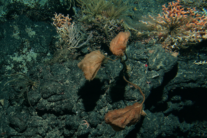
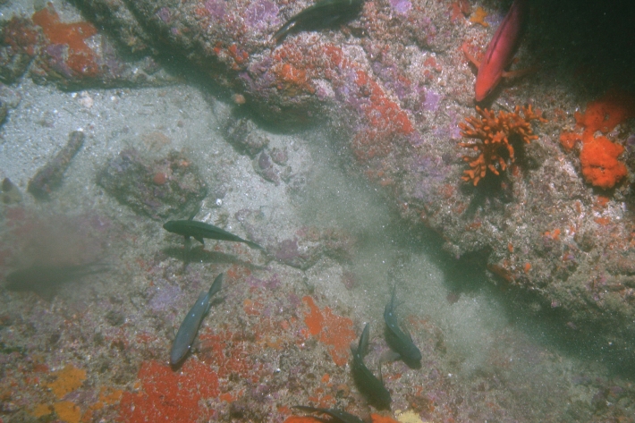
Unique animal communities may need special protection
Media release18 March 2015New Zealand’s underwater mountains are home to unique animal communities which need careful environmental management, new research reveals. -
NIWA's National Freshwater Fish Database goes hi-tech
News article16 August 2013Next week, NIWA scientists will showcase the latest version of the National Freshwater Fish Database at an international conference in Hamilton. -
Quantum Map - licence
NIWA Quantum Map is developed by Sourcepole for NIWA, based on Quantum GIS and is released under the same licence and conditions as Quantum GIS. -
New Zealand: first in the world to catalogue all its species through all of time
News article18 May 2012New Zealand is the first country in the world to catalogue its entire known living and fossil life. -
Neon applications software
The Neon Applications software is a suite of software and documentation which allows clients to set up their own Neon system on existing server hardware, or new server hardware located at the client’s premises. -

Environmental information services
NIWA provides a multitude of monitoring and information services underpinning New Zealand's science and environmental management: sky-to-sea, sensor-to-service, data-to-knowledge. -
Mapping marine biodiversity in Bay of Islands
Research ProjectBuilding a publicly-available database from the results of a marine mapping survey of the Bay of Islands provides us with a stocktake of the local aquatic resource, in turn giving us valuable information on what areas we can better manage for the future.