NIWA Forecast is NIWA’s dedicated forecasting and information software. It is run on NIWA’s High Performance Computing Facility and uses our wealth of climate data and high resolution forecasting models to generate forecast graphs, tables and maps. These help clients with operational, planning and risk management decision making. You can see some examples below.
We work with clients to install the software and provide training – this ranges from installation on a single machine for an individual user, to installation on a server to be made available for many employees across multiple offices. We also offer 24/7 on-call technical support.
Alongside installing NIWA Forecast and providing training, we can customise outputs, layouts and maps to meet your needs, and enable staff to set up their own alerts and access historic information.
Product features and outputs:
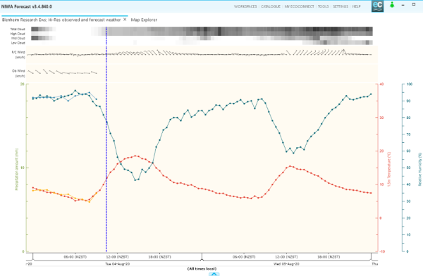
Charts
View real-time and historic meteorological observations and forecasts for weather and climate stations. You can even view seagrams of forecast sea conditions.
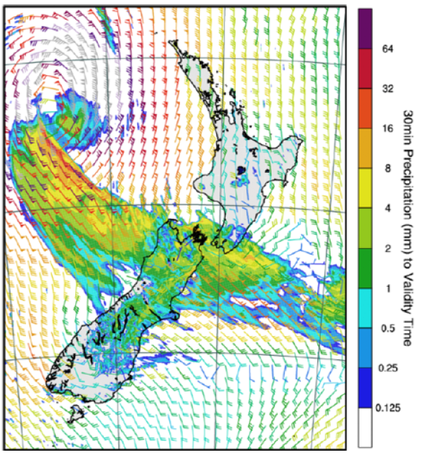
Maps
Access maps of observations (satellite imagery, sea surface temperatures) or forecasts from NIWA’s in house models. Whether it’s maps of wind speed and direction, cloud cover or even UV, maps can be customised to meet your needs.
Alerts and custom reports
NIWA Forecast can alert you (via SMS or email) if a certain forecast or observation threshold you have set has been met. You can also create custom report templates with the data you need to share and set these up to be automatically emailed to those who need the information.