Seabed mapping in Marlborough uncovers 10 shipwrecks
The most detailed seafloor mapping of a coastal region off New Zealand has been completed in Marlborough.
It's produced navigational charts that haven't been updated since the 1940s, and has even found previously undiscovered boats and shipwrecks.
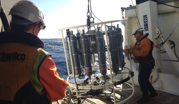
NIWA's Ikatere was one of two vessels that spent 280 days out on the water of Queen Charlotte Sound and the Tory Channel to create what's being called the best view of any seabed in New Zealand.
Helen Neil, NIWA's general manager of operations, said it combines the safety of navigation with habitat mapping - down to 400 metres at its deepest point.

Helen Neil, NIWA's general manager of operations, was interviewed by Newshub at the Sounds Survey Public Information Evening in Picton. Watch the news report and interview on the Newshub website (link at the bottom of this article).
"We've found sediment waves, which has sand dunes the size you see in the Sahara, just sitting under the water in Cook Strait - metres high and hundreds of metres apart," she said.
Data manager Kevin McKay said soundwaves from multibeam echo sounders are reflected off the seafloor, enabling surveyors to map the habitat in detail.
"This is something no human has seen before, and I feel like I'm an explorer like James Cook or Christopher Columbus," he said.
They collected data for navigation, but also about marine life and its habitat.
"Fantastic rocky reefs covered in amazing biodiversity, covered in kelp, kina and paua. We see spotties and juvenile blue cod feeding on them," Ms Neil said.
And then, there are the shipwrecks - 10 of them in total.
"All of a sudden this thing emerges out of the murkiness. There's a bow, there's a superstructure - it's a shipwreck!" Mr McKay said.
Marlborough was chosen for the $3 million project because of its iconic status and expected growth in the use of the area.
Minister for Land Information, Eugenie Sage, said the Queen Charlotte Sound is a priority area for marine farming, cruise ships and ferries.
"It's really popular with recreational boaties, and a really significant marine environment," she said.
The mapping can also see damage caused by scallop dredging, and scars on the seabed from ships dropping anchor.
One scientist described the exercise as "pulling back the aquatic veil". It's hoped the information will set a benchmark for the restoration and protection of the area.
The next joint project for mapping is Fiordland.