A weekly update describing soil moisture across the country to help assess whether severely to extremely dry conditions are occurring or imminent. Regions experiencing these soil moisture deficits are deemed “hotspots”. Persistent hotspot regions have the potential to develop into drought.

Facts: soil moisture
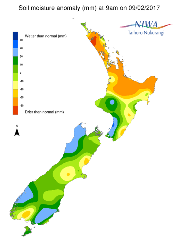
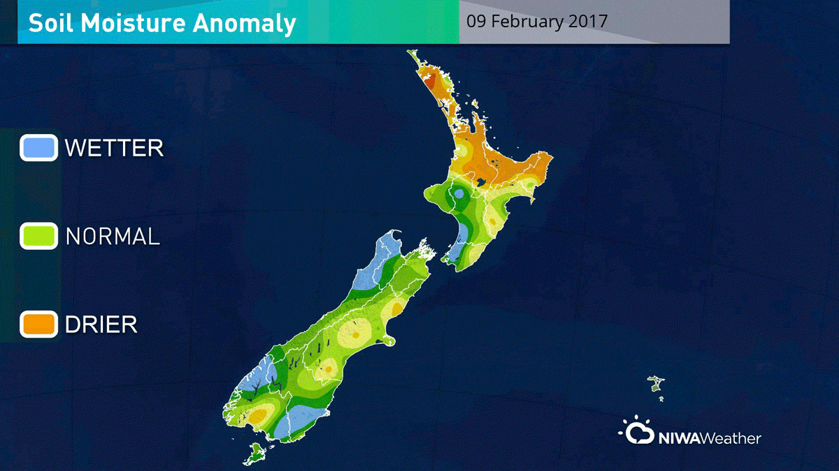
Across the North Island, soil moisture levels have generally increased during the past week. Increases were most substantial in Northland and driven by an atmospheric river that transported abundant tropical moisture from near New Caledonia and Vanuatu to northern New Zealand. Soil conditions in Auckland, Waikato, and the Bay of Plenty also benefited from the moderate to heavy rain event. The wettest soils across the North Island compared to normal for this time of the year are now actually found across the Far North District, the same region that had the driest soils compared to normal this time last week. The driest soils for this time of year are across the Coromandel Peninsula and East Cape.
Hotspots have been alleviated across all of Northland, much of Auckland, the western Bay of Plenty, and Waikato except for the Coromandel Peninsula. Hotspots remain in place across the eastern Bay of Plenty through East Cape as well as on the Mahia Peninsula and in coastal Wairarapa.
Across the South Island, soil moisture levels this week are quite similar to last week. The most notable change is across middle and northern Canterbury where soil moisture is severely drier than normal in some places. The driest soils compared to normal for this time of year are found across the Hurunui, Selwyn, and Ashburton Districts where hotspots are now in place. The wettest soils compared to normal for this time of year are found across Fiordland.
Outlook and soil moisture
For the North Island, locally heavy showers and thunderstorms are forecast on Saturday, particularly from near and south of the Waikato region. While rainfall will generally be between 5 and 15 mm, isolated amounts in excess of 25 mm are possible especially across the Central Plateau. Generally speaking, amounts are most likely to be less than 10 mm across Auckland and Northland, however isolated higher amounts are possible with heavy showers. With a similar setup on Sunday, showers and thunderstorms are again likely across the North Island, most widespread across the Central Plateau. Rain will again average 5 to 15 mm with locally higher (and lower) amounts. A trend toward drier weather is expected on Monday, though showers and thunderstorms may persist in the Waikato, Taranaki, and Manawatu-Whanganui regions with rainfall amounts of 5 to 10 mm. Dry for most on Tuesday and Wednesday. A chance for light showers in eastern areas on Thursday and central and northern areas on Friday with amounts no more than a few millimetres.
With widespread rain across the North Island through the weekend, further hotspot alleviation is anticipated. Soil moisture levels will continue to increase across the central North Island in particular. No new hotspots are expected to develop over the next week.
For the South Island, light rain on Saturday will affect middle and northern Canterbury as well as the upper portion of the island. Amounts greater than 10 mm will be the exception with many locales observing 3 mm or less. Mostly dry on Sunday except for odd showers along Banks Peninsula as well as Marlborough, Nelson, and the Alps. Mainly dry on Monday, then rain increasing across Southland and Westland on Tuesday and Otago on Tuesday night. Rainfall between 25 and 50 mm across Fiordland and Westland while lower amounts of 5 to 15 mm are expected across Southland and Otago. Isolated showers bringing less than 5 mm are possible across the central South Island on Wednesday. Hotspot areas across Canterbury are not expected to receive much appreciable rain from this event. Dry weather is anticipated across the island on Thursday and Friday.
Over the next week, limited rainfall in the north and east will lead to further drying of the soils. Hotspots across Canterbury may expand and intensify. Hotspot development will be monitored across Marlborough as well as interior Southland where soils are currently slightly drier than normal for the time of year.
Background
Hotspot Watch a weekly advisory service for New Zealand media. It provides soil moisture and precipitation measurements around the country to help assess whether extremely dry conditions are imminent.
Soil moisture deficit: the amount of water needed to bring the soil moisture content back to field capacity, which is the maximum amount of water the soil can hold.
Soil moisture anomaly: the difference between the historical normal soil moisture deficit (or surplus) for a given time of year and actual soil moisture deficits.
Definitions: “Extremely” and “severely” dry soils are based on a combination of the current soil moisture status and the difference from normal soil moisture (see soil moisture maps)