NIWA reveals seabed treasures
Three new posters of the Cook Strait and Wellington Harbour seabed reveal for the first time a treasure trove of detailed information for the benefit of all New Zealanders.
The National Institute of Water & Atmospheric Research (NIWA) CEO John Morgan will present a framed poster of the Cook Strait seabed to the Minister of Research, Science and Technology the Hon Dr Wayne Mapp at parliament today.
The information will produce significant economic benefit for both sides of the Cook Strait, revealing new potential for fisheries, recreational diving, tourism, environmental conservation, hazard mitigation, and energy production.
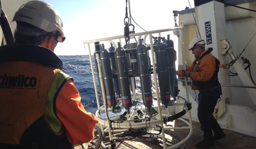
These posters are the product of sophisticated seafloor mapping combined with expert marine geological knowledge.
The poster “Beneath the Waves – Wellington Harbour” is the result of a survey of Wellington Harbour which used almost six billion soundings collected from a multibeam echosounder transmitting a fan of sound beams. This poster reveals many details around the port, marinas, and river mouth, the South Seas ship wreck, freshwater springs, faults, and sediment patterns produced by the action of storm waves and tidal currents on fine sediments.
The two posters “Cook Strait” and “The Dynamic Seabed of Cook Strait” reveal the Cook Strait seafloor in high resolution for the first time.
Cook Strait owes it origins to tectonic faulting, landslide-scarred canyons, rough seas, changes in sea level, and vigorous tidal currents that scour the seafloor.
Several major geological faults extend into Cook Strait from the south Wellington and Marlborough coasts, and are earthquake hazards. Scientists use seabed mapping tools to identify the location of the active faults, determine their rate of movement, the size of earthquakes they are capable of producing, and how often these earthquakes may occur.
Determining the earthquake risk and improving disaster preparedness is critical for Wellington City. The geological and oceanographic knowledge that underpins these posters – including new knowledge of submarine faults, in addition to those on land – are key to the simulations and hazard models that scientists are building. Until very recently only the faults on land have been able to be analysed.
The new posters also reveal potential tsunami hazards from underwater landslides which are typically much larger than those on land. Some landslides in Cook Strait range in volume from 2.5 million cubic metres to approximately ten cubic kilometres.
The new information is already being applied to current engineering problems of great national significance. As NIWA’s Dr Philip Barnes, Principal Scientist says: “Transpower manage the high voltage cable system coming from the South Island to the North Island. The new data will assist with planning and management of existing and future seafloor cables in this part of the national electricity grid.”
The posters are the culmination of an exceptional team effort at NIWA, supported by funding from the Foundation for Research, Science and Technology, the Department of Conservation, and Greater Wellington Regional Council.