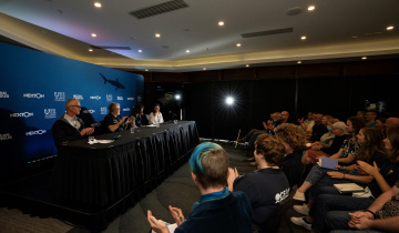
Mapping our future, for the worlds oceans
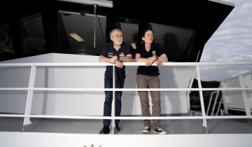
A team of international scientists, led by NIWA Oceanographer Dr Philip Boyd, departs from Auckland on 6 June and sails towards the waters South of New Caledonia this week. They are onboard Research Vessel Tangaroa, for the second leg of the GEOTRACES programme: a ten-year international study of trace elements in the marine environment.
New Zealand is one of twenty countries participating in the GEOTRACES programme. The programme is designed to identify the processes that determine the distributions of the key trace elements in the ocean, and how these relate to changing environmental conditions.
Voyage leader Dr Philip Boyd says that the team will “pick up the second leg of a >13,000 km transect in the Pacific from Brisbane straight across to Lima, Peru. It’s a large tract of ocean. We are vertically sampling trace elements every degree of longitude along 32.5 S from 172W to 150W.”
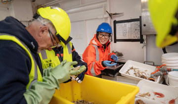
“We are collecting water samples, particle samples, and atmospheric aerosols that supply metals to the ocean. With concentrations less than parts per billion, we have to use Kevlar line to deploy our sampling instruments down to 5 km depth, and our instruments have to be scrupulously cleaned,” says Dr Boyd.
The GEOTRACES programme is looking at how ocean currents drive the movement and distribution of trace elements in the marine environment. The measurements made by the scientists on board Tangaroa as they voyage across the Pacific give a 2D slice that will be combined with measurements from the rest of GEOTRACES to “build a 3D picture of how oceans move these trace elements around,” says Dr Boyd.
Trace elements and their isotopes play important roles in the ocean as nutrients or in some cases contaminants. Different ocean basins have different nutrient concentrations.
This knowledge of how nutrients circulate in the oceans is very important to our understanding of how the watery part of the planet works. “It’s a bit like trying to understand the human body if you didn’t know how blood circulated through it,” says Dr Boyd.
In the 1960s scientists undertook a momentous survey, the Geochemical Ocean Sections (GEOSECS) programme. It was the first time anyone had mapped important properties of the ocean such as carbon dioxide, oxygen, salinity and temperature and the concentrations of all the major nutrients.
“It gave us the first real look-see of how ocean circulation affects important things for our life support system – Earth’s climate. In addition to nitrogen and phosphorous marine plants require trace elements to support the foodwebs of the ocean on which we depend. This is a new attempt to do the same things for these important trace elements as we did back in the 1960s for the major elements,” says Dr Boyd.
Trace elements, and the processes that determine their distribution in the marine environment, have direct implications for research in such diverse areas as the carbon cycle, climate change, ocean ecosystems and environmental contamination.
Using maps produced from the first leg of the GEOTRACES Atlantic Ocean programme, scientists “discovered new sources of some of these trace elements. Large amounts are coming in from hydrothermal vents,” says Dr Boyd.
Several of the trace elements being studied play crucial roles in cell physiology and in biochemical reactions. Their supply is thought to control the structure and, possibly, the productivity of marine ecosystems.
“Synthesis and modelling of GEOTRACES findings will produce a more accurate understanding of changing ocean conditions in the past, and will improve our ability to incorporate trace element cycles into models to predict ocean responses to future global change,” says Dr Boyd.
All the maps will be completed in 2020. The programme will cost US $200 million. New Zealand funding was Ministry of Science and Innovation (MSI).
Background:
The GEOTRACES mission can be expressed as three overriding goals:
- To determine full water column distributions of selected trace elements and isotopes, including their concentration, chemical speciation, and physical form, along a sufficient number of sections in each ocean basin to establish the principal relationships between these distributions and with more traditional hydrographic parameters;
- To evaluate the sources, sinks, and internal cycling of these species and thereby characterize more completely the physical, chemical and biological processes regulating their distributions, and the sensitivity of these processes to global change; and
- To understand the processes that control the concentrations of geochemical species used for proxies of the past environment, both in the water column and in the substrates that reflect the water column.
GEOTRACES will be global in scope, consisting of ocean sections complemented by regional process studies. Sections and process studies will combine fieldwork, laboratory experiments and modelling. Beyond realizing the scientific objectives identified above, a natural outcome of this work will be to build a community of marine scientists who understand the processes regulating trace element cycles sufficiently well to exploit this knowledge reliably in future interdisciplinary studies.