Discovery voyage of Ross Sea begins
On 27 January 2004 a team of scientists set out from Wellington on board NIWA’s research vessel Tangaroa bound for the Ross Sea in Antarctica.
2 February 2004
The voyage is designed to help fulfil New Zealand’s international obligation to ensure the safe passage and anchorage of vessels in the Ross Sea Dependency, and to improve our understanding and knowledge of the biodiversity of the Ross Sea.
The project runs through to 13 March, and is jointly funded by Land Information New Zealand (LINZ) and the Ministry of Fisheries (MFish), in cooperation with the Italian Antarctic Research Programme. Besides Tangaroa, the Italian research vessel Italica will also be involved in the biodiversity studies. (Read more about Tangaroa and Italica in a special Antarctic issue of Water & Atmosphere).
While in Antarctica NIWA will continue the survey work it began in 2001 for LINZ, which led to the development of the first hydrographic charts of the Ross Sea. ‘Navigating through the icy waters of the Ross Sea can be hazardous for the increasing number of research vessels and cruise liners entering the area, but the journey will be substantially safer when we have completed mapping the shipping lanes in the area,’ said NIWA’s marine project director Fred Smits.
The focus for the hydrographic survey is the region from Cape Adare to Cape Hallett, but LINZ will also consider mapping the areas around Balleny Islands and Scott Island if the ice conditions do not allow work to begin or continue in the Ross Sea.
‘Statistically, each year the survey areas are free of ice only for a short period between mid February and early March, so it’s quite possible that we’ll only be able to survey part of the area this year,’ said Mr Smits. ‘We may need to conduct more surveys in the future to complete the work, especially the hydrographic surveys of chart inserts and marine areas. However, we’re hopeful of completing a substantial part of the work this summer because the ice conditions appear to be very favourable this year.’
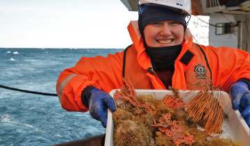
Scientists will also research the biodiversity of marine communities on the Ross Sea shelf and the seamounts around the Balleny Islands. This part of the voyage, funded by MFish through the New Zealand Biodiversity Strategy research programme ‘BioRoss’, is highly likely to discover species new to the region and to science, and will provide valuable baseline biodiversity information for the Commission for the Conservation of Antarctic Marine Living Resources.
‘The marine research team will describe and quantify the diversity of bottom dwelling invertebrates and fish communities, and try to determine the importance of different environmental factors influencing these communities,’ said Ministry of Fisheries Science Manager (Biodiversity) Jacqui Burgess in a press statement.
‘Previous research on species diversity and abundance has revealed strong patterns, but there’s insufficient information to predict the likely impact on Ross Sea marine communities of changes in ice conditions resulting from climate change or human activities. In order to collect as much information as possible, a system called “Multibeam” will be used. This is an acoustic mapping tool that shows a picture of the seafloor, and allows scientists to examine the communities living there. Grabs, dredges, and trawl nets will be used to retrieve specimens.’
Ship’s log
You can view the daily diary and voyage discoveries at MFish’s Ross Sea Voyage 2004 website (www.rosssea2004.govt.nz), where you’ll find other school resources as well.
Voyage timing
RV Tangaroa is scheduled to reach Cape Adare on 3 February
Survey programme to 6 March
Back to Wellington on 13 March