2019 so far - a story of weather and climate extremes
We’re now halfway through 2019 and NIWA climate data from the first six months tell a dramatic story of weather and climate extremes.
“During summer, heatwave conditions scorched our seas for the second consecutive year, while several areas of the country suffered ongoing drought conditions, including Nelson-Tasman where prolonged wildfires occurred and a state of emergency was declared,” says NIWA meteorologist Ben Noll.
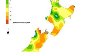
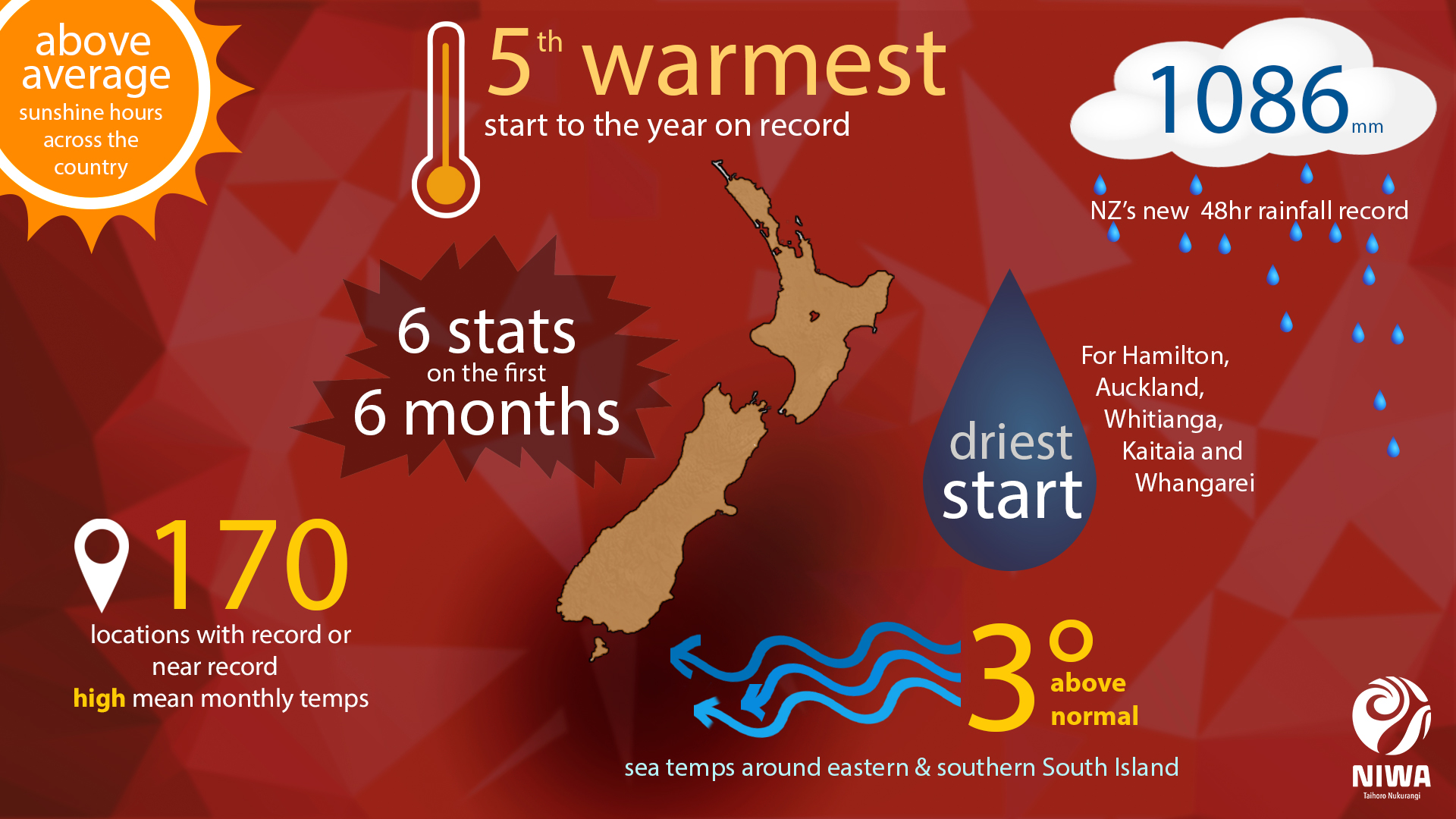
All up, 2019 saw the driest January to June on record for Auckland (321.2 mm, 62% of normal), Hamilton (275.8 mm, 53% of normal) Whangarei (277.8 mm, 44% of normal), Whitianga (332.8 mm, 39% of normal), and Kaitaia (238.4 mm, 36% of normal).
“The country had a very bright start to the year, with a vast majority of regions experiencing more sunshine than normal – wider Nelson recorded the highest January-June sunshine hour total on record (1445.6 hours),” says Mr Noll.
Overall, it was the fifth warmest start to the year on record with a nationwide anomaly of +0.99˚C, according to NIWA’s seven station temperature series which began in 1909.
“In contrast to the drought, we also saw a record-breaking rainfall event along the West Coast during March. This was fueled by an atmospheric river and the warm Tasman Sea,” he says.
By the numbers:
- 170: the number of times that record or near record high monthly mean temperatures were reached between January-June 2019.
- 3: in stark contrast to the above, there were only 3 near record low mean monthly temperatures.
- 3 degrees above the norm – the year-to-date figure for sea surface temperatures in coastal areas around the eastern and southern South Island.
- 1086 mm of rain fell in 48 hours at Cropp River on the West Coast between 25-27 March – a new 48-hour rainfall record.