Coastal hazards: exposure, impacts and risk
Coastal hazards, driven by more extreme coastal physical processes (including coinciding factors), can cause damage, disruption and even casualties in estuaries, river mouths, open coasts and coastal/shelf waters.
Climate change is exacerbating many of these hazards, especially the ongoing rise in sea level, and already changing the frequency and magnitude of damaging events.
This core project is provides improved knowledge and tools on coastal hazards, how often they may pose a threat and potential consequences (risk) in New Zealand – both now and in the future as sea level continues to rise.
The problem
New Zealanders love their coast. We take pride in our maritime heritage, ocean resources, recreational opportunities, and beach holiday houses, yet sometimes the sea and adjacent coastal margins can be hazardous places.
Most coastal hazards can be grouped into five main impacts, usually with several contributing processes causing an event or cumulative harm:
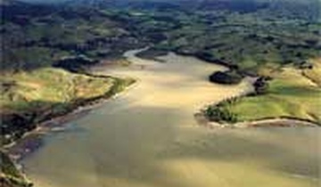
- coastal erosion and shoreline stability (including river mouths, tidal inlets and cliffs) from waves, storm tide, changes in sediment budgets, river floods, coastal structures, stormwater and sea-level rise
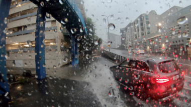
- coastal flooding from storm tide, wave overtopping, river floods, tsunami and sea-level rise
- elevated groundwater levels in coastal plains from storm tide, intense rainfall, sea-level rise, and salinization
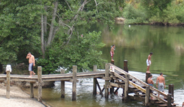
- recreational activities with hazards arising from surf zone conditions (e.g.rips, wave conditions, long-wave surges) )
- maritime activities with navigation hazards arising from wave/swell conditions, storm tide, strong winds, low tides, long-wave surges and tsunami.
In recent times, New Zealand has been spared from any major coastal disaster or damage, but we remember the sinking of the inter-island ferry Wahine (1968), the February 1936 storm – the most destructive of the 20th Century – that caused $800M damage across the North Island, and the 3 to 10-m-high tsunami after the 1855 Wairarapa earthquake.
However, already the frequency of flooding or wave overtopping is increasing (e.g. Tamaki Drive - Auckland, south Wellington coast, Avon-Heathcote estuary, South Dunedin) and will become a common occurrence (e.g. yearly) in low-lying areas with only a modest rise in sea level of 30–45 cm (depending on tide range).
The risks (combining consequences and likelihood), from coastal hazards will rise substantially as sea level continues to rise and waves and storm surge increase. This increase in risk comes from both the rising hazard exposure and also the rising value of real estate and infrastructure and further development around coastal and estuarine margins.
All these factors, along with the uncertainty in sea-level rise mean we have to adaptively respond by planning adaptation pathways for new and existing development on our coastal margins and for maritime activities.
The solution
The coastal hazards programme is about providing improved knowledge of the causes, the probability of occurrence and the potential consequences of coastal hazards in New Zealand, both now and for various future scenarios for a range of possible sea-level rise.
The initial focus is on attaining a much better understanding of the wide range of coastal hazards, and how, when and where they might occur and tools to visualize the hazard such as flood or tsunami inundation maps or coastal erosion hazard zones (we call this ”hazard exposure”) This is being achieved by field and numerical model studies, statistical analysis of extreme hazard magnitudes and post-event surveys following a damaging event, backed up by monitoring or camera networks to measure tides, sea level, tsunami, coastal erosion, waves, winds and surf conditions (surf rips).
Results of the research and expert knowledge gained from the coastal hazards programme are being amalgamated in predictive computer models, e.g. different models to simulate tides, storm surge, wave/swell and sediment-transport or coastal erosion. These physical-process models are the foundation for the operational forecasting models that NIWA runs, which rely on an accurate high-resolution weather forecasting model to derive rainfall, winds, barometric pressure that drive the various coastal hazards.
Outputs from coastal hazard-exposure model simulations or hazard maps are then used in RiskScape to overlay on built environment assets (e.g. buildings, roads) and distribution of the resident population, to determine the present and future risk of harm and damage. Further, this programme contributes to the ongoing development of coastal planning policy and guidance for local government and input to adaptive engineering design of coastal infrastructure (e.g. roads, ports, marinas, airports).
The programme aims to help enhance New Zealand’s ability to respond to and reduce the risks from coastal hazards and, better still, plan for their emergence in areas are not already impacted as sea level continues to rise.
Benefits will be through more informed preparedness for coastal flooding, tsunami inundation or maritime conditions through timely and accurate forecasts, improved approaches for managing shoreline erosion, accurate estimates of extreme event magnitudes for coastal engineering design, through to long-term planning for the impacts of coastal hazards and sea-level rise on low-lying coastal margins (locally and nationally). One example of the latter is the recent report on Preparing for Rising Seas by the Parliamentary Commissioner for the Environment and associated NIWA reports.
Contact