Management of riparian areas exerts a strong influence on the health of streams and downstream water bodies. Management of riparian vegetation and stock access influences stream temperature and plant growth; sediment, pathogen, and nutrient levels; food webs; and physical habitat.
The importance of these various functions of riparian areas varies greatly depending on stream and land characteristics and the local waterway management issues. For example, channel width influences the importance of riparian shade and litter input, and the land use, slope, and drainage characteristics influence runoff filtering by riparian soils and vegetation. Addressing important waterway issues requires riparian management to match key riparian functions.
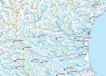
NIWA has recently worked with Environment Waikato, Environment Canterbury, and MfE to develop a Riparian Management Classification (RMC) to incorporate spatial variations in riparian functions into riparian management planning. Various approaches to RMC have been developed for streams in Canterbury. We used results of rapid assessments of 12 riparian functions at over 330 sites to group sites according to their current and potential ratings. Models were developed to predict site groups (e.g., sites that rated low, medium, or high for various combinations of functions), or the ratings for individual riparian functions (e.g., runoff filtering, streambank stabilisation), from information on stream and land characteristics in the River Environment Classification (REC) and Land Environments New Zealand (LENZ) databases. These predictions were mapped for the whole Canterbury region and will be used to develop new riparian guidelines.
RMC provides a tool to move beyond 'one size fits all' approaches to riparian management and hence to improve its effectiveness for protecting and restoring aquatic ecosystems from land use impacts. The recent report is available online at www.niwa.co.nz/ncwr/tools.
John Quinn [ [email protected] ] Cathie Brumley [ [email protected] ]
