Secrets brought to light
Buried treasure isn’t always gold or silver. NIWA scientists Brandon Goeller and John-Mark Woolley are trialling a range of cutting-edge technologies to uncover hidden contaminant flow paths under agricultural land.
Vast networks of underground streams, springs and drains can provide pathways for nutrients and sediments that end up in surface water. New Zealand’s diverse landscapes, climatic conditions, and farming practices can make it challenging for farmers to determine how and where excess nutrients, sediment, and faecal microbes enter waterways. It is important to accurately map, characterise, and quantify the hydrological flow paths that transport these contaminants from the land, so farmers can target the right mitigation solutions at the right locations for their farm environments - a crucial part of improving downstream water quality.
How can we find these hydrological pathways if they are hidden underground? “Ground Penetrating Radar is one of the technologies NIWA is trialling to map the dominant subsurface flow paths” says Brandon, a post-doctoral fellow at NIWA Hamilton.
Ground Penetrating Radar (GPR) transmits radio waves into the ground that bounce off subsurface interfaces with contrasting electrical properties. The returning energy at different depths is measured by a receiving antenna. Hundreds of these measurements are collected each time the GPR system is towed across a survey area. When stacked alongside each other, these measurements allow researchers to construct images of the structure of the subsurface environment.
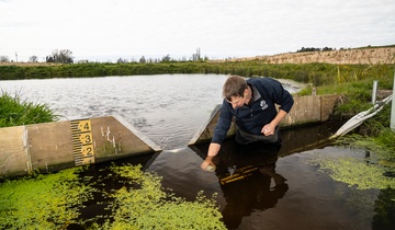
Recently, Brandon and John-Mark spent the day traversing a 4ha cow paddock in the Toenepi catchment, a Waikato dairy farm-dominated catchment. They towed a plastic sled bearing one of NIWA’s Mala GroundExplorer GPR antennas. The GPR was used to image buried soil layer boundaries, farm water and drainage infrastructure, and other features that influence subsurface water flow.
Brandon and John-Mark identified subsurface tile drains, old surface drainage channels, and shallow groundwater springs from the GPR images. John-Mark will further process the GPR data to produce two-dimensional images of the subsurface for each survey transect. Any gaps in the two-dimensional images will be filled in using estimates from surrounding data to create a three-dimensional subsurface model of the survey area.
“From the three-dimensional images, we can effectively remove the soils that sit on top of our layers of interest. This allows us to look at the topography of the underlying layers” says John-Mark.
“The exciting part is that farmers can use identified surface elevation points to target the subsurface features that might transport contaminants, without having to undertake costly and disruptive excavations.”
The datasets produced can also be used for hydrological analyses of subsurface water flow paths using GIS software. This work is being done in collaboration with NIWA hydrologists who are modelling surface runoff and groundwater diffuse pollutant fluxes at catchment-scales.
GPR is just one of the technologies being investigated to map and quantify surface and subsurface flow paths at farm scales. Digital terrain analysis using light detection and ranging data, and multi-spectral and thermal infrared imagery are also being trialled.
“Our aim is to find the right blend of remote sensing technologies to generate the data needed to produce a GIS-based framework. Farmers and other land managers will be able to use the framework to select the most effective contaminant mitigation tools for their catchments” says Brandon.
Contact