New Zealand boasts around 425,000 km of rivers and streams, with half of these being small headwater streams. Many of these small first order streams have never been accurately captured digitally, meaning that the true hydrological extent of many catchments is poorly or incompletely known.
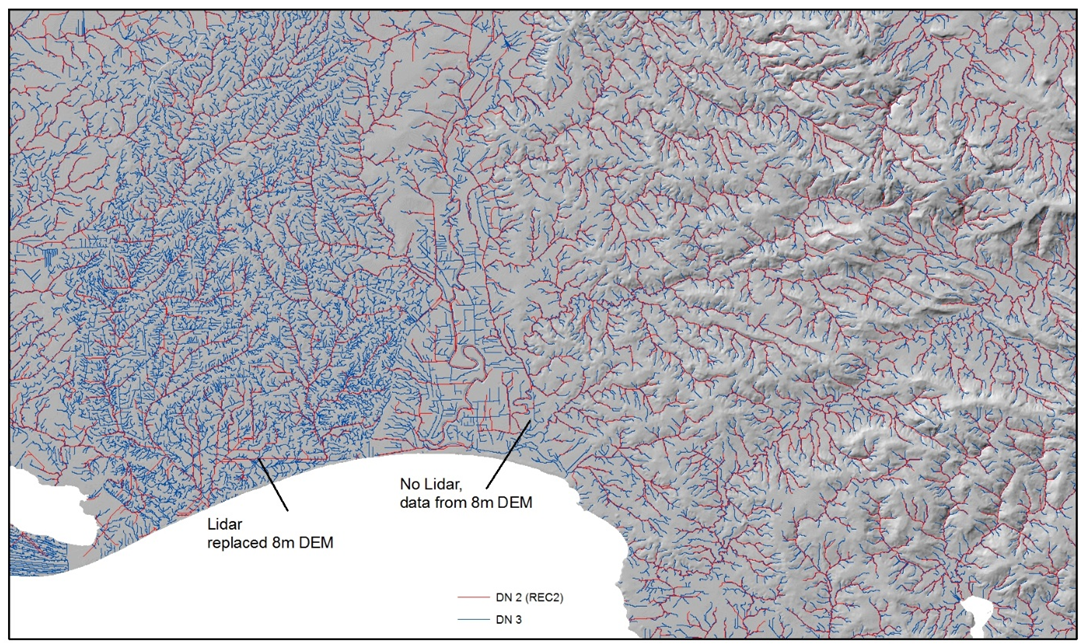
Over the past year, we have been working with Regional Councils to use their point elevation data and remote sensing information from LiDaR surveys to improve the resolution of the national River Environment Classification (REC) digital stream network layer (or DN). This builds on work in the Southland region in 2015 in partnership with Environment Southland as part of Land and Water 2020 Fluxes and Flows hydrological programme. The improved stream network definition for Southland was so marked that we have since invested core funding to extend the high resolution mapping across the entire country. Dubbed DN3, as an upgrade to the digital stream network layer than underpins the current version of REC (version 2), the first iteration of this new network should be completed and freely available to most North Island regional councils by 30 June. The remainder of the North Island and the South Island DN3 will be available by June 2018.
As well as many regional applications, an improved description of the national river network will improve the performance of GIS-based catchment water quality and water quantity modelling tools such as CLUES, TopNET, EFSAP and CHES, which make use of the REC river segments as the basic spatial architecture to perform their calculations.