The tropical Pacific continues to edge towards El Niño, but the atmosphere is still not showing patterns typical of El Niño.
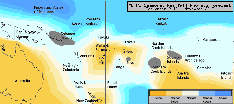
The dynamical rainfall forecasts for the September to November season show enhanced rainfall over the western part of the maritime continent north of the Equator, and an ITCZ displaced south of its climatological position east of the Dateline.
There is less agreement on the position of the SPCZ, leading to weak forecast guidance for some Island groups.
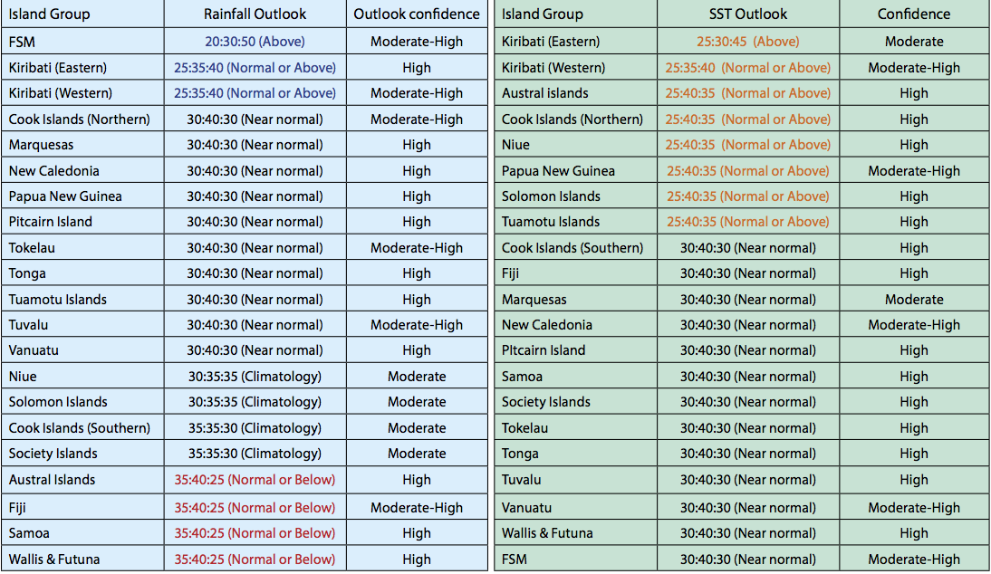
Above normal rainfall is expected for the Federated States of Micronesia.
Near or above normal rainfall is forecast for Eastern Kiribati and Western Kiribati.
Near normal rainfall is expected for the Northern Cook Islands, the Marquesas, New Caledonia, Papua New Guinea, Pitcairn Island, Tokelau, Tonga, the Tuamotu Archipelago, Tuvalu and Vanuatu.
Normal or below normal rainfall is expected for Fiji, Samoa, the Austral Islands and Wallis & Futuna.
No clear guidance is given for Niue, the Solomon Islands, the Southern Cook Islands and the Society Islands.
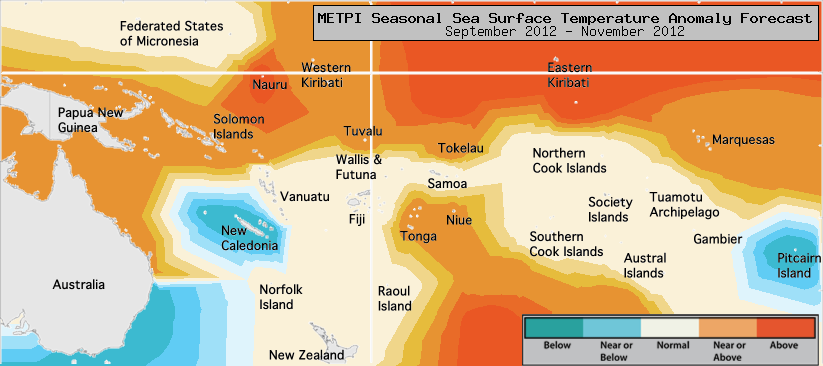
The global model ensemble continues to show development of El Niño–like sea surface temperatures signals, with an indication of warm anomalies in the equatorial region, especially to the east of the Dateline in the coming three months.
Above normal SSTs are forecast for Eastern Kiribati.
Near normal or above normal SSTs are forecast for Papua New Guinea, the Solomon Islands, Niue, Tonga, Tuvalu, Tokelau, the Marquesas and Eastern Kiribati.
Normal or below normal SSTs are forecast for New Caledonia and Pitcairn Island. Near normal SSTs are forecast elsewhere.
The confidence for the rainfall outlook is moderate to high. The average region–wide hit rate for rainfall forecasts issued in September is 66%, 3 points higher than the long–term average for all months combined.
The SST forecast confidence is moderate to high across the region, and uncertainty is greatest near Eastern Kiribati and the Marquesas.