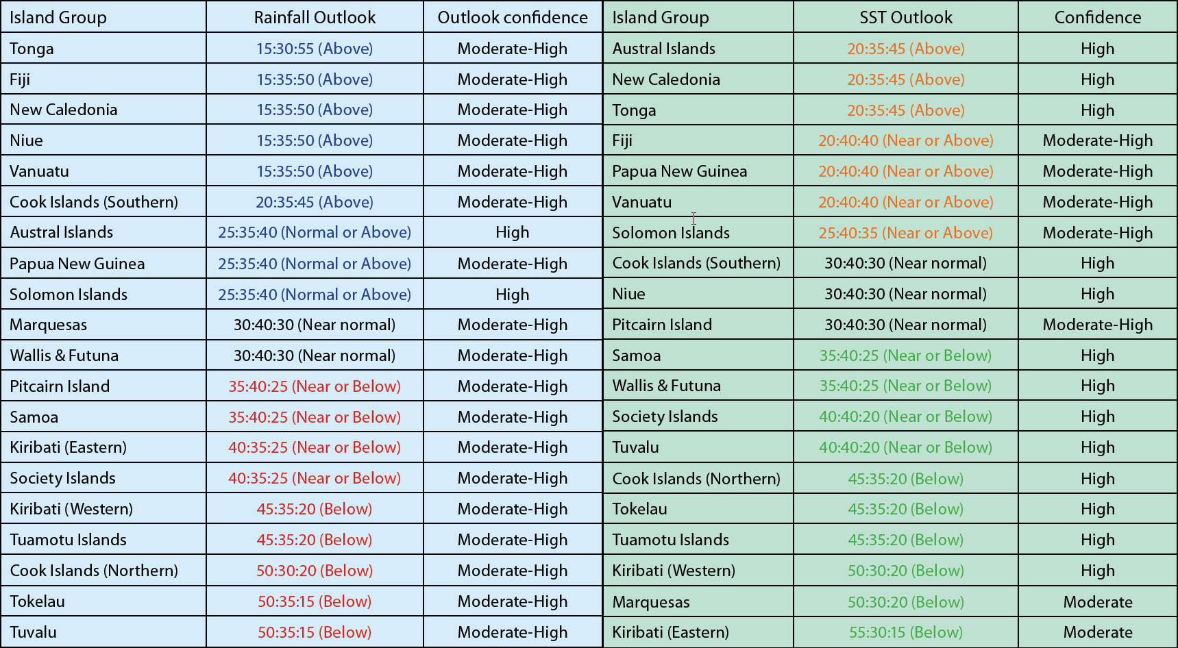
A La Niña pattern exists in the ensemble of globalclimate forecasts.
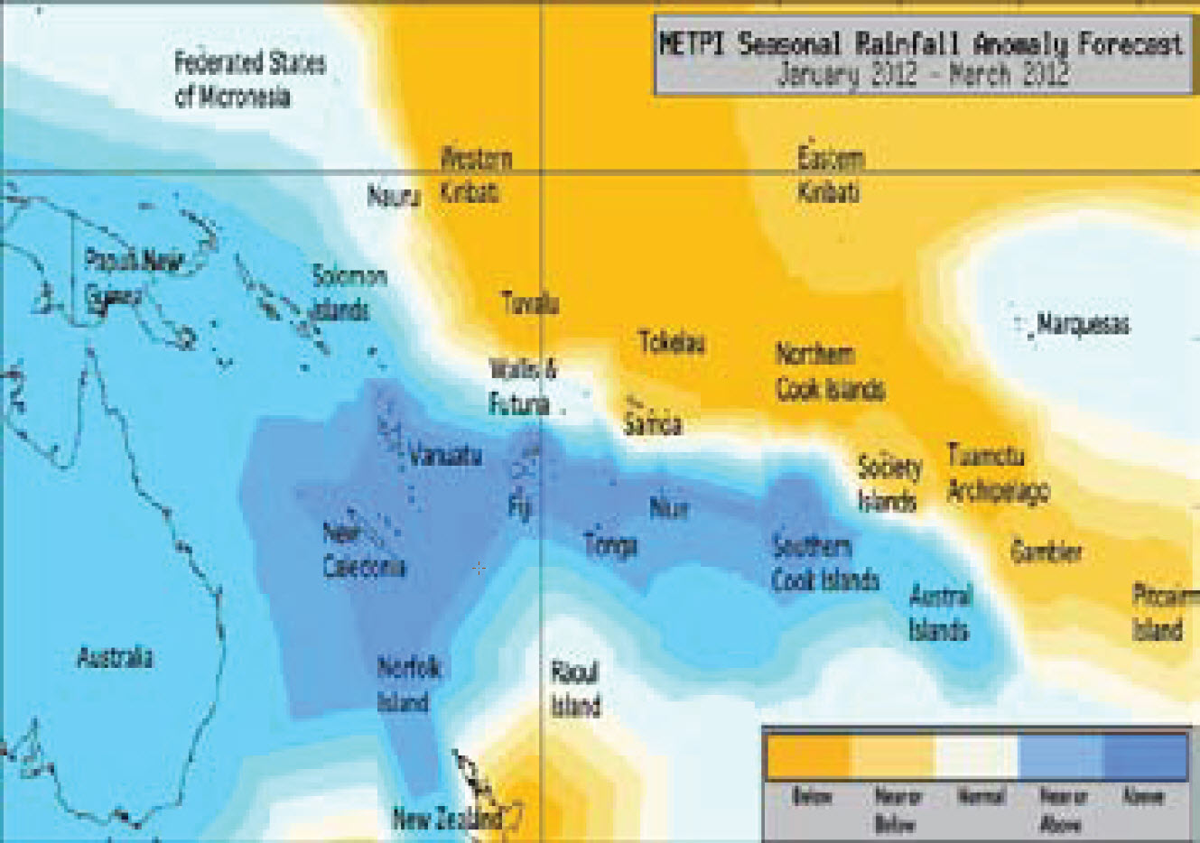
A La Niña pattern exists in the ensemble of globalclimate forecasts. Suppressed convection is expected in the southwest Pacific near Tuvalu, Tokelau, the Tuamotu Archipelago, the Northern Cook Islands, and Western Kiribati which are forecast to receive below normal rainfall in the coming three months.
Despite intermittent rainfall, significant drought in Tuvalu, Tokelau and the Northern Cook Islands is expected to continue but is anticipated to ease as La Niña weakens in late summer. Average or below average rainfall is expected for the Society Islands, Eastern Kiribati, Samoa, and Pitcairn Island. The SPCZ is likely to be southwest of normal during the forecast period.
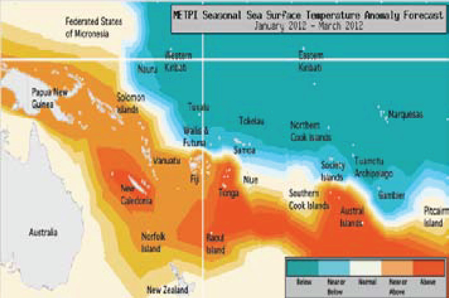
Above normal rainfall is likely for Vanuatu, New Caledonia, Fiji, Tonga, Niue and the Southern Cook Islands. Near or above average rainfall is forecast for the Solomon Islands, Papua New Guinea and the Austral Islands. Near normal rainfall is expected for the Marquesas and Wallis & Futuna. For the next three months, below normal SSTs are expected for Eastern Kiribati, Western Kiribati, Tokelau, the Tuamotu Archipelago, the Marquesas and the Northern Cook Islands.
Normal or below normal SSTs are forecast for Tuvalu, the Society Islands, Wallis & Futuna and Samoa. Above normal SSTs are forecast for Tonga, New Caledonia, and the Austral Islands. Near normal or above normal sea surface temperatures are forecast for Papua New Guinea, Vanuatu, Fiji, and the Solomon Islands. Near normal SSTs are forecast for the Southern Cook Islands, Niue and Pitcairn Island. The confidence for the rainfall outlook is moderately high.
The average region–wide hit rate for rainfall forecasts issued in January is 58%, four percent lower than the long–term average for all months combined. The SST forecast confidence is mostly high, with greatest uncertainty near the Marquesas and Eastern Kiribati